Shenandoah, Day 2
2019-06-27
Shenondoah National Park, VA
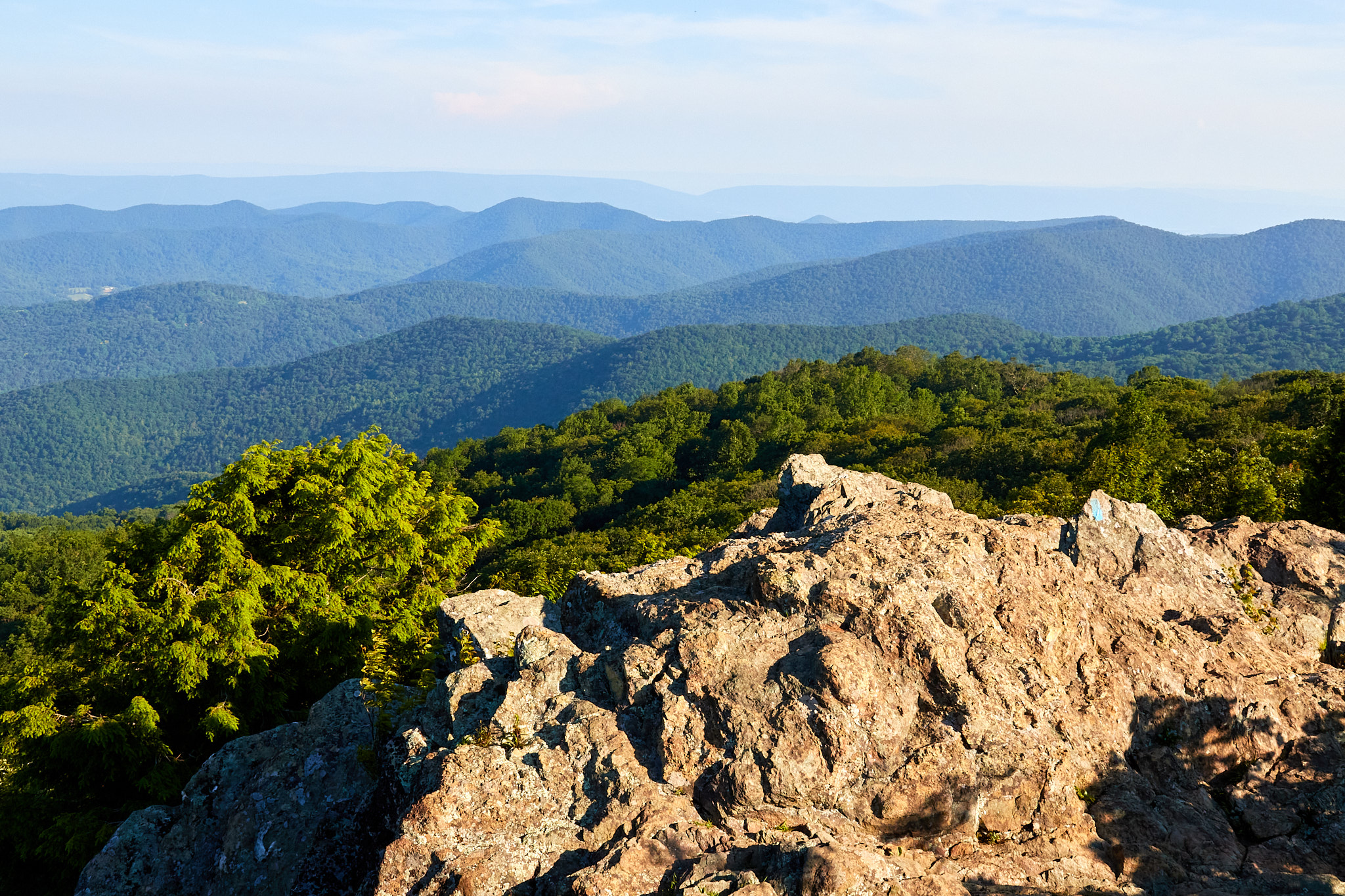
I had planned to start the morning with the Dark Hollow Falls hike, It's supposed to be a nice hike but very popular so I figured getting it done early made sense. Sadly the parking lot was blocked with cones so I figured the trail was closed. Instead I went south to do the Bearfence Scramble hike. It's a short hike at around a mile, but it does live up to its name and provide an opportunity to use all four limbs to get up the mountain. Luckily it's well-marked up the rocks, and frankly fun if you don't mind scrambling. I spent some time at the top, which I knew was the top because the fellow sitting there said it was the highest point he had reached on his trek from the opposite direction, as it was for me. I think that's the mathematical definition of a maximum. It also turns out this hike was unique because it went upwards from Skyline Drive; almost everything else starts downward.
I came down the back way, which drops you on the Appalachian Trail (AT) to finish the loop. As far as I'm concerned, that makes me an AT Section Hiker. Sure, the Through Hikers who go the whole 2200 miles from Georgia to Maine get all the glory, but us Section Hikers work just as hard for the distances we travel. That quarter mile was, well, actually, it was relatively flat and easy. OK, maybe they do work a bit harder.
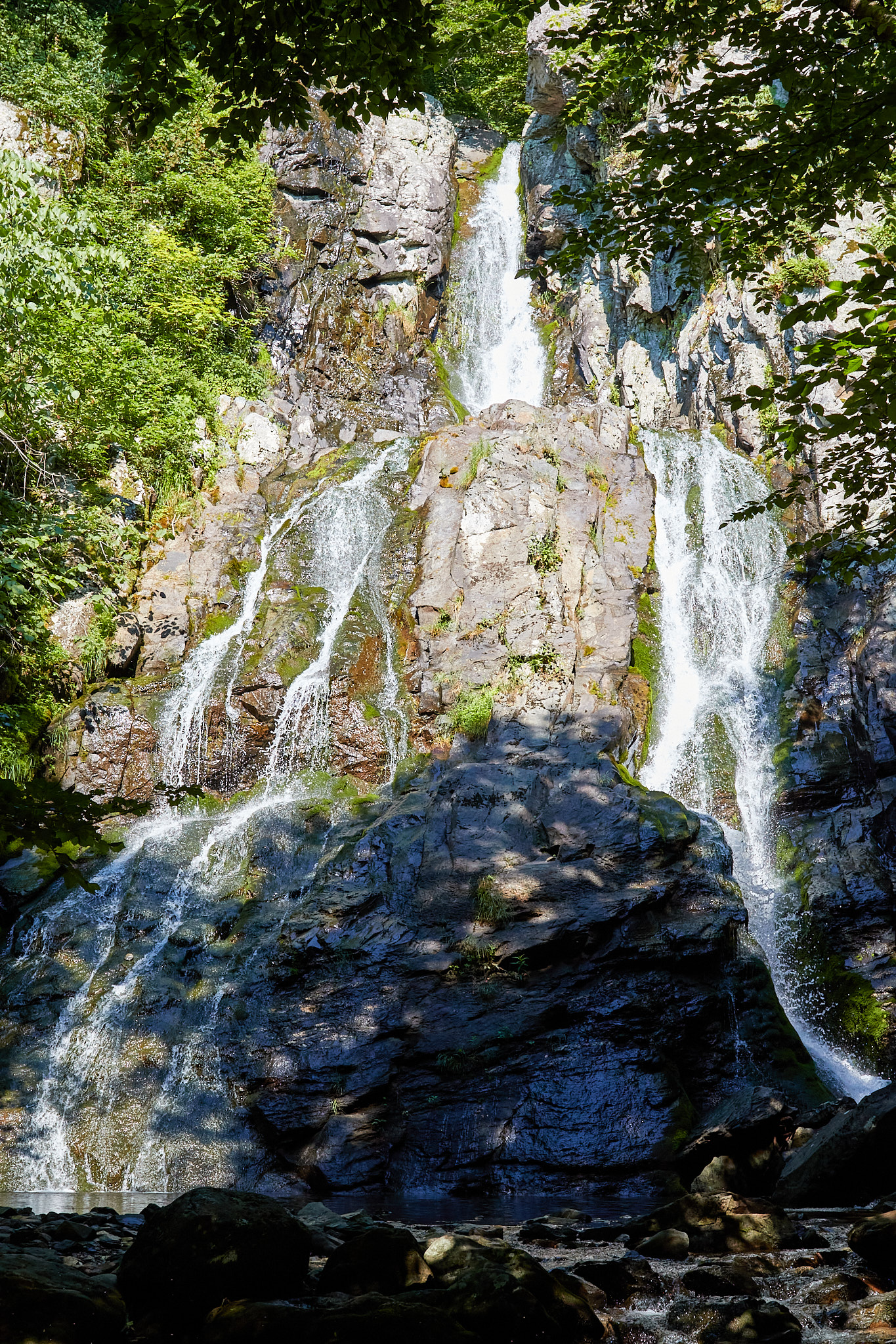
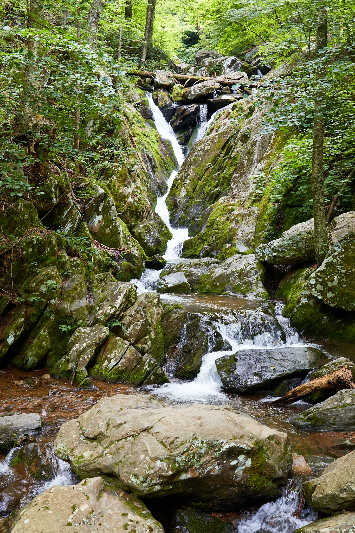
I traveled further south on Skyline Drive to my next hike, the South River Falls Trail Loop. It's more of an out-and-back with two trail choices for the middle third (so some variety), and stops at the base of a 60 foot waterfall. This hike is green. Lots and lots of lush green vegetation with a few mossy rocks to break it up with more green. You feel like you are far into the wilderness after just half a mile.
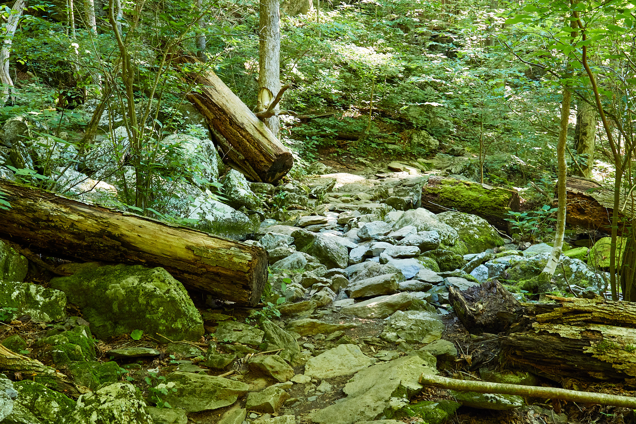
The river is in a valley, and you drop maybe 1000 or so feet to follow the creek to the overlook of the top of the falls (spoiler alert: it's bushy so you can't see much). You can then continue down another 500 or so feet to the floor, and then take a narrow ledge trail to the falls itself. It's an excellent waterfall. However, once your done enjoying it, that 1500 feet of climb is your hiking partner for the next two miles. Total distance was about 4.5 miles.
Once again the trail used part of the AT to return to the start. I met a nice young lady through-hiker taking a break at the intersection. She said she had hiked 900 miles so far. That's a fair haul just to say hi to me, if I do say so myself.
After finishing my hike, I visited the ranger station at Big Meadows next, ostensibly to check out the display (but more to suck up their air conditioning). It was only in the low 80's, but the high humidity just made it feel much hotter. While I was there I learned that the Dark Hollow parking lot was closed (for restriping) but the trail was open. I decided I'd hike it a bit later, after 4 PM, hoping for cooler and less crowded. I then lounged at my campsite for a few hours in the shade.
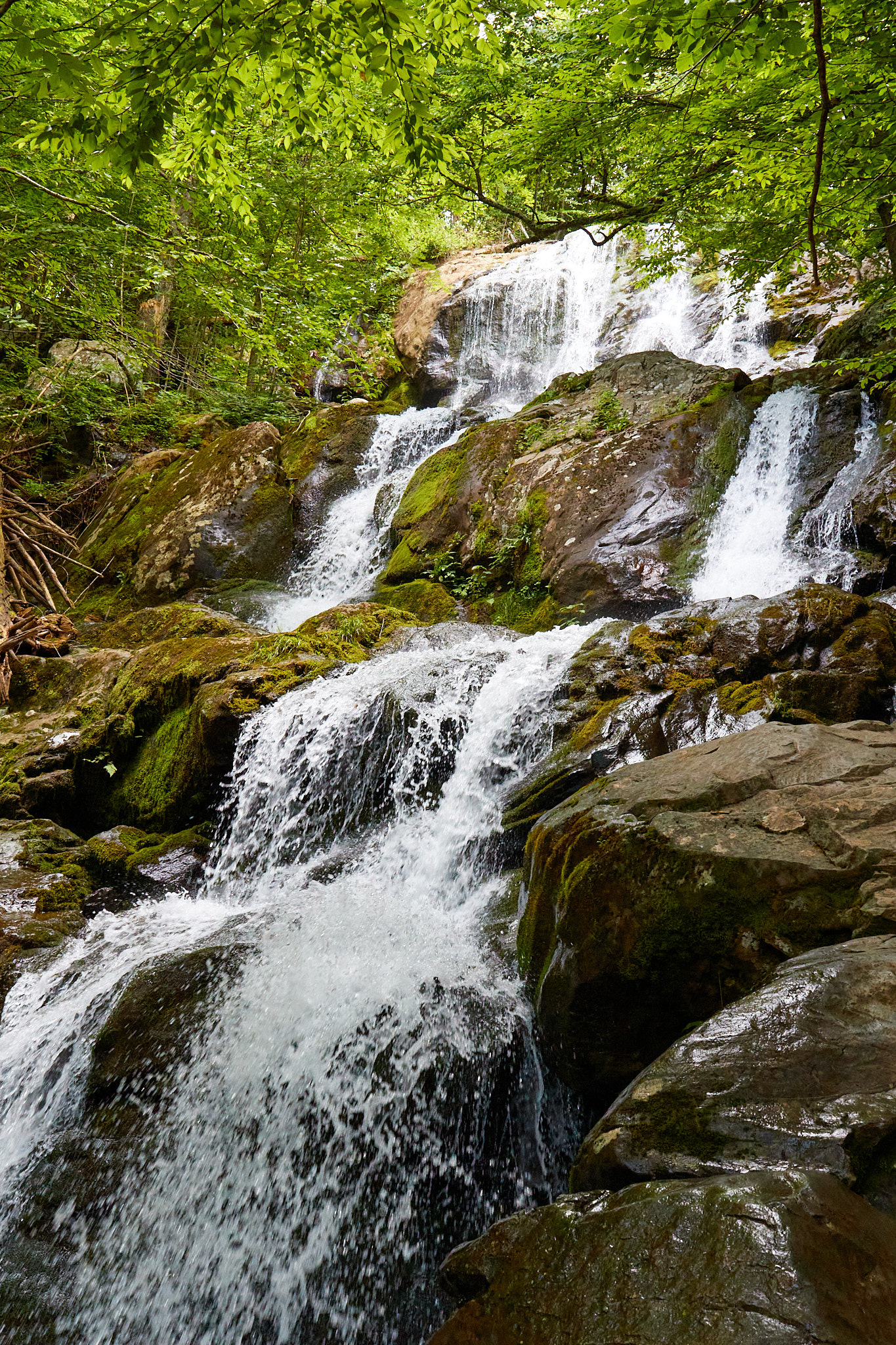
The Dark Hollow Falls trail was only a bit more than a 1.6 miles out and back, and that's going all the way to the second falls. It involved a mere 630 feet of climb over three-quarters of a mile, with pretty much the entire return trip being uphill. The falls were quite lovely, and I continued on to the second falls figuring I wouldn't get back this way any time soon. The fact it was relatively unvisited as a bonus; most people wisely stopped at the first falls so that their children wouldn't have as long a climb out.
That's a total of about 7 miles for the day, but because of the heat and constant hills it feels like much more. We will see how far I want to go tomorrow.