Back in the USA
2019-09-04
Upper Peninsula, MI
I finished the Canadian portion of my trip today, which gives me an opportunity for a few concluding remarks. First off, I traveled through the country having touched zero Canadian currency. Society may not be cashless, but for a few days you can make it, no problem. Granted I did have to resist the urge to pick up a nickel on the ground, but it was a very weak urge. I also realized (when the Customs officer asked) that I brought back literally nothing physical from Canada except a couple sheets of paper with park maps and rules. Also, on an unrelated note, one of the locals pointed out to me that it's the best time of year to visit the north because all the potholes (at least the ones they are going to fix for the year) have been fixed, and the new ones haven't hatched yet.
The one thing I don't understand is why the Canadians use a "picnic table" symbol to mean "bathrooms." When you're driving down the road and need to use a bathroom, look for the blue picnic table signs pointing to the right or left. These are rest areas. Of the ones I stopped at, there were none that I would want to have a picnic in. Most didn't even have a picnic table; just a pit toilet and a small dirt parking lot. While these were certainly welcome at the time, I don't see why they use that sign. I guess there must be a cultural euphemism here, but it was confusing until I lucked into the key.
Once I left Sudbury I traveled hundreds of kilometers on the Trans Canada highway to Sault St. Marie (pronounced "Soo Saint Marie" on both sides of the border) arriving about noon. After crossing a really cool bridge, there was no line and I went through customs in less than a minute. Since I renewed my passport a few months back, I figured I'd use my passport card to cross. I wouldn't even have gotten the card since it's only good for driving across borders, but I thought about this upcoming trip, plus the whole problem with my driver's license not being usable for flying even in the US (I'm less likely to forget the card if I get it into my wallet early). Since then I've gone back to the DOT - just one year after renewing my license - for a real ID. I brought my old license, my passport, my SS card, and my truck registration to prove my address. I am sure that the DOT has that last one, but it is not our place to question. Oh, and a check. Don't forget the most important document!
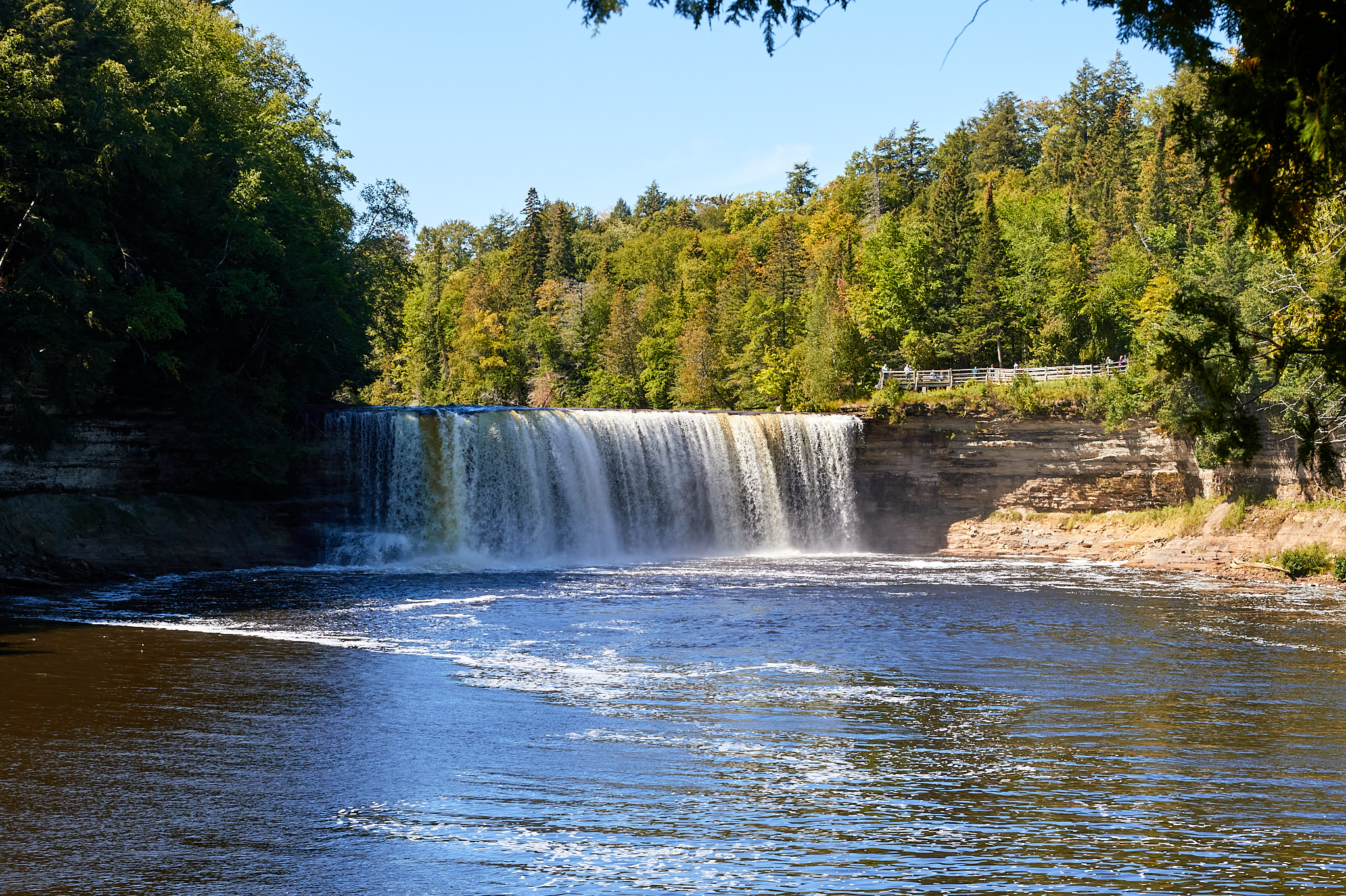
Continuing on in the good ol' USA, I stopped at the Upper Tahquamenon (rhymes with "phenomenon") Falls as a nice place to take a break after about five hours in the saddle. It's also colloquially known as Root Beer Falls because it is brown due to the tannin washing down from the surrounding countryside, and frothy because the water is soft. However, it wasn't particularly brown or frothy today because of all the rain over the past couple days diluting both effects. There is also a Lower Tahquamenon Falls, but there the river is more spread out and it is less impressive. Since I've been there before, I opted to skip that one this trip.
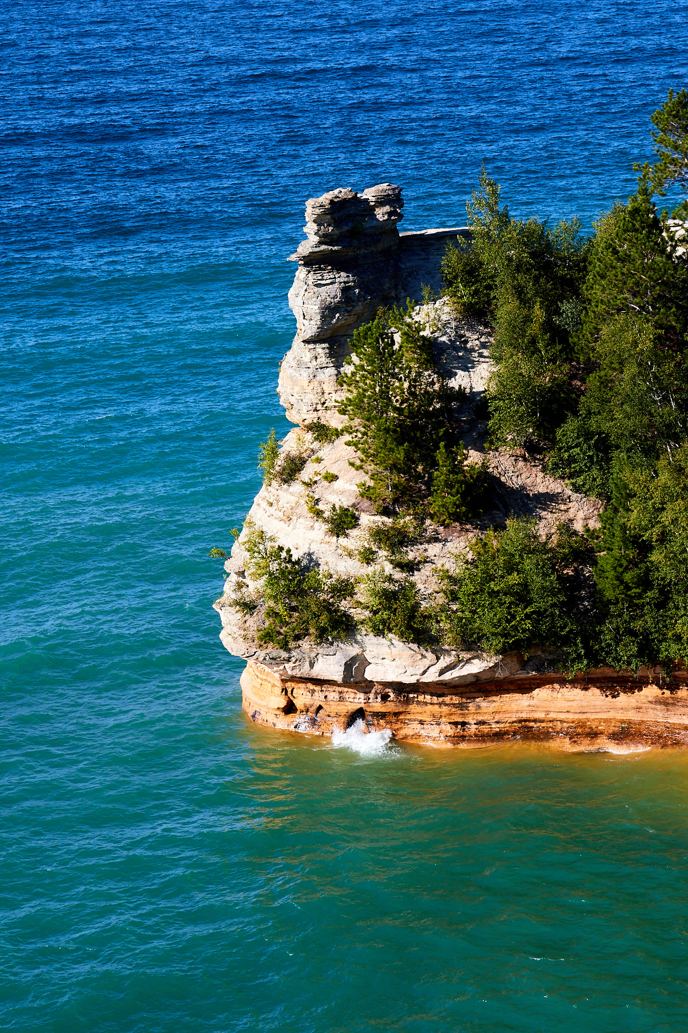
Back on the road, another two hours took me to the Grand Sable Ranger Station where I confirmed my options for hiking, checked on closures, etc. With four hours of daylight left, next up was Miner's Castle. It's an interesting rock formation on a point and maybe a quarter mile hike if you want to go down to it as well. It used to have another turret, but it collapsed about ten years ago. I'm glad I got to see this one.
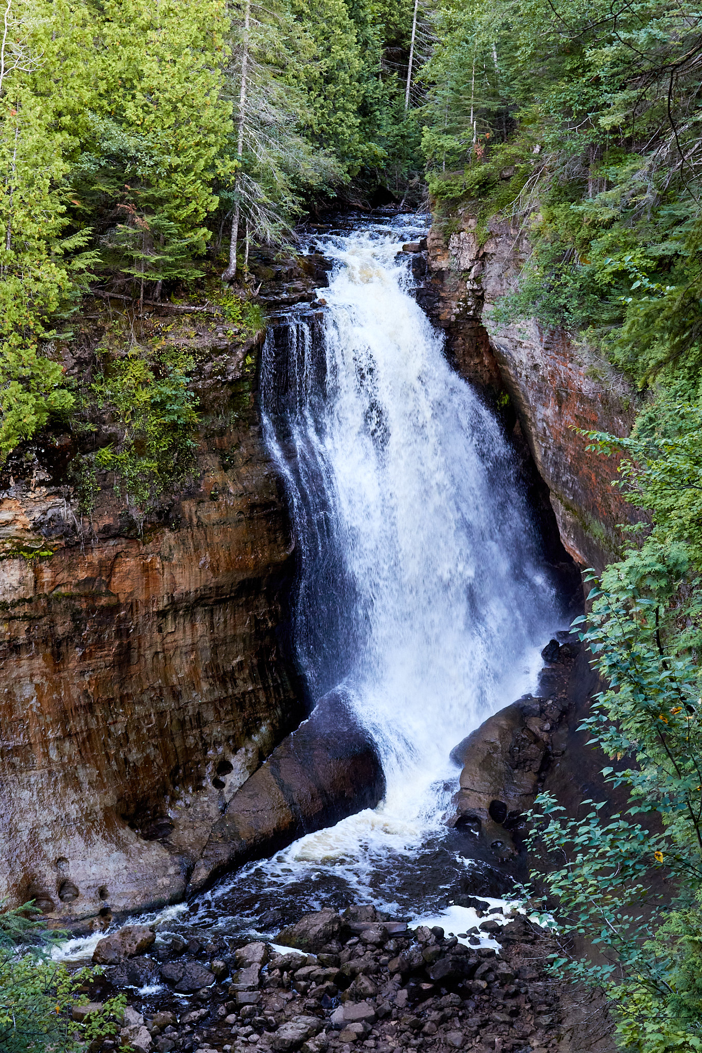
Nearby was Miner's Falls. It's only a mile or so round trip to the falls, but it turned out to be a particularly good waterfall. It was well worth the time.
Finally I made it to my campground at Twelve Mile Beach. I pitched my tent and settled in for what would be a chilly evening. I have even donned a long-sleeve shirt while I type this. Nope, no pictures. You will have to imagine what I look like with sleeves.
Hiking Distance: 3.5 miles