High Trestle Bridge
2022-07-21
IA, IL, IN
Gas is much more expensive this trip than previous ones. If you are wondering, I have paid anywhere from about $4.30 to about $5.30 a gallon for gas (rounding out the tenths of a cent that haven't made sense since the 40's). Price is dictated by location; remote stations in resort areas are the highest (Aspen crowning them all of course) while towns on the interstate in the Midwest are the cheapest. The weird thing is that for many of the midwestern states they are advertising prices around $3, but when you get to the pump you find that is for the middle gas which has more ethanol. While that gas is fine, it does go fewer miles per gallon. Race car mechanics say that cars burn about twice as much pure alcohol as pure racing gas. Thus dollars per gallon is lower, but miles per gallon is also lower. Unfortunately there is no way to calculate miles per dollar without actually trying it in your car although I wouldn't be surprised if the ethanol blend is a better value. I always went with the full gas because I wanted the maximum miles per tank (~550 miles) just in case I got stuck in traffic or surrounded by bison. The average mileage calculated by the car was around 31 MPG for the entire trip. Keeping the tires inflated helped, and high altitude made that easy for a while.
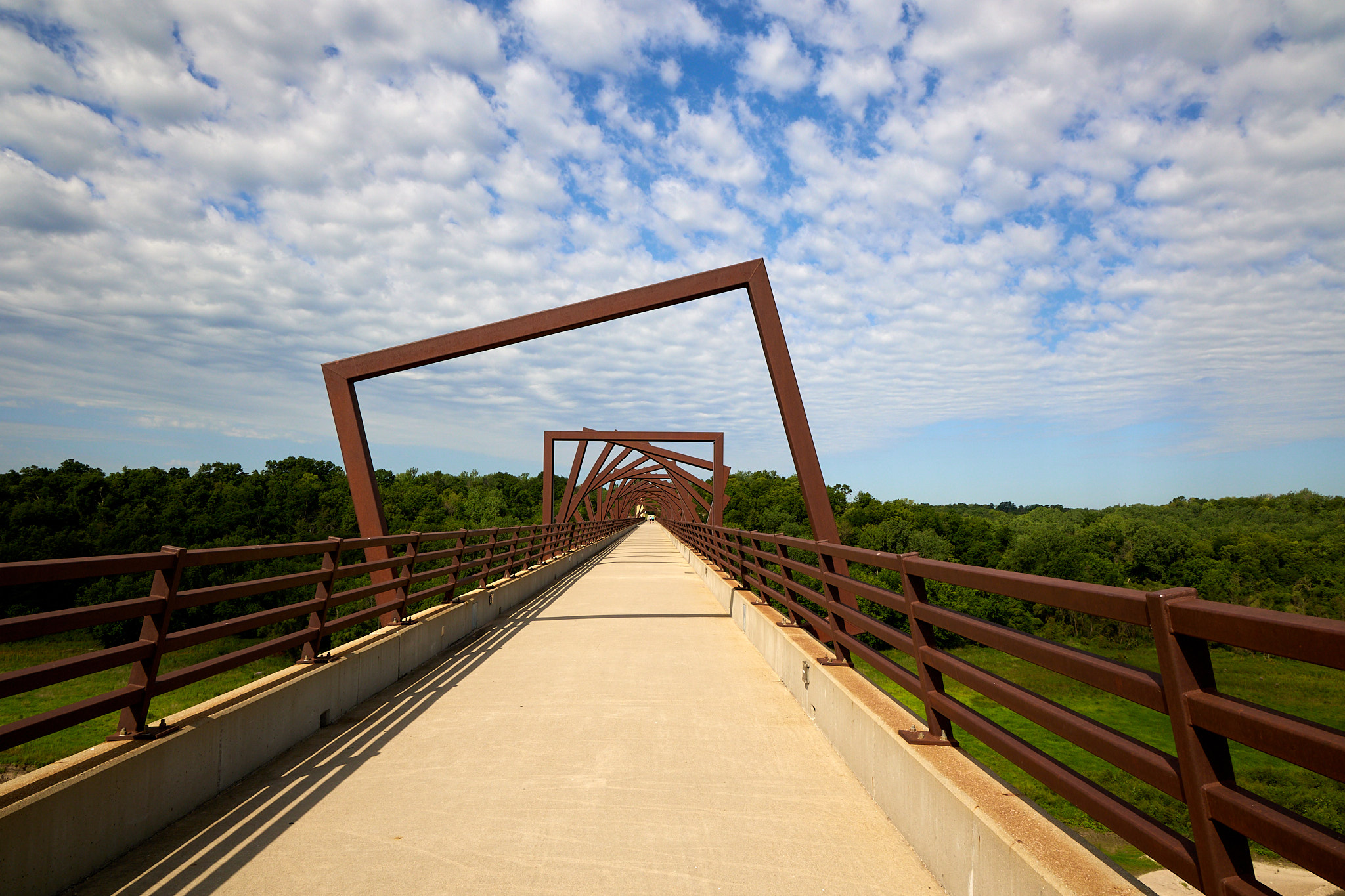
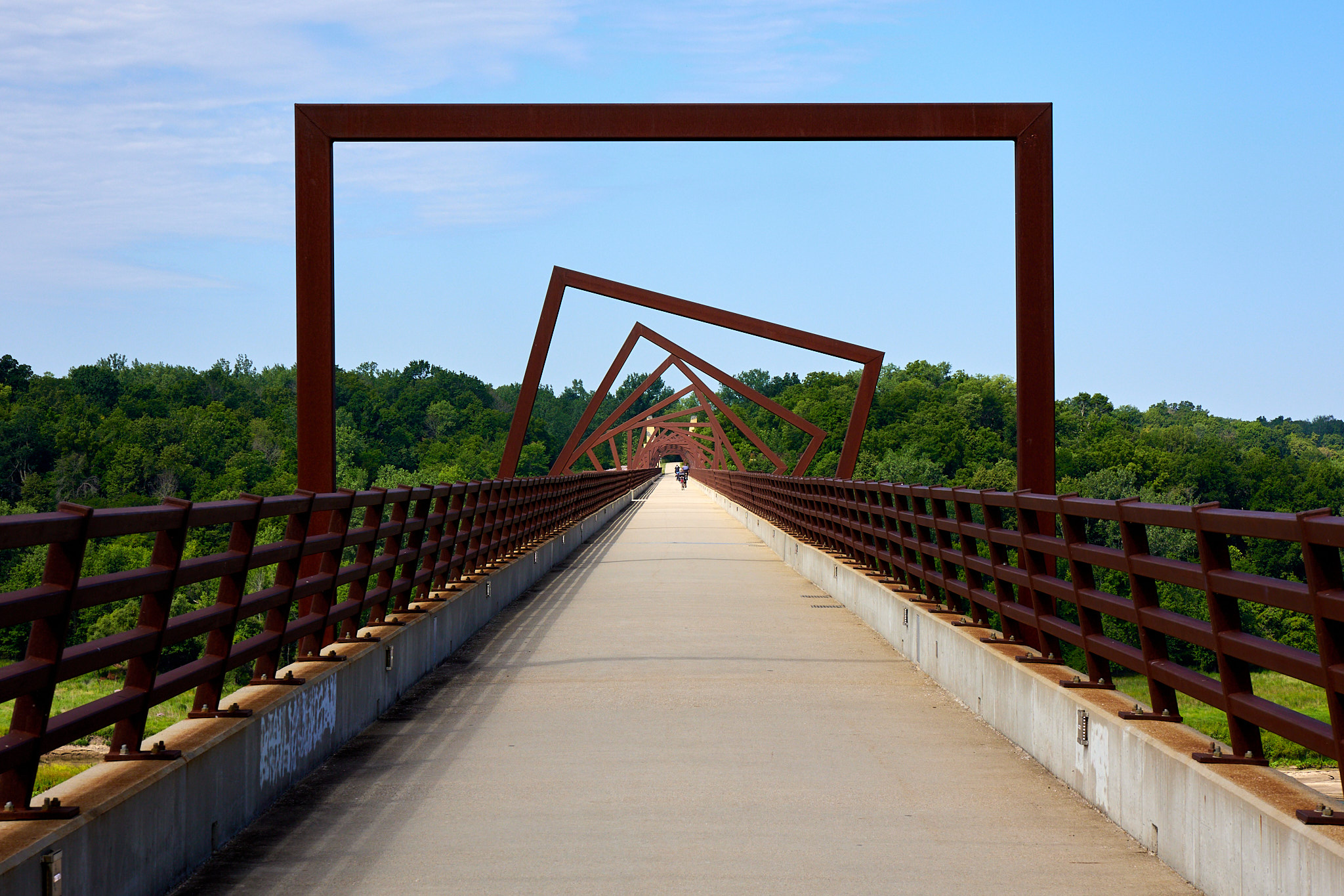
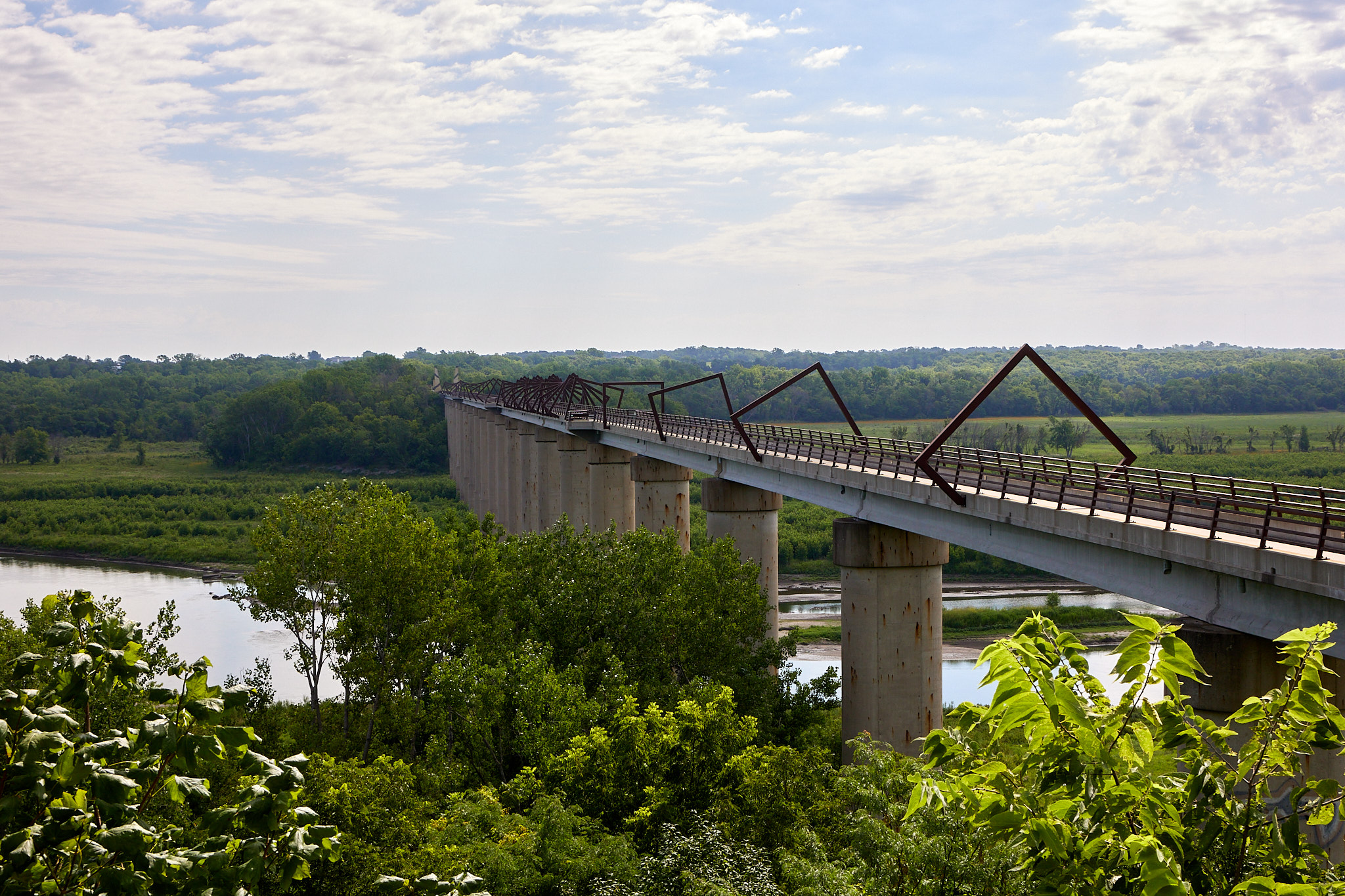
Today we got on the road early as usual, and drove about two hours to Madrid where we sought the High Trestle Bridge Trail. This was the first time Google Maps let me down today. It took me to some random place in the middle of a road near said bridge but a ways from the trail. We regrouped, found a trailhead by name, and Google took us there.
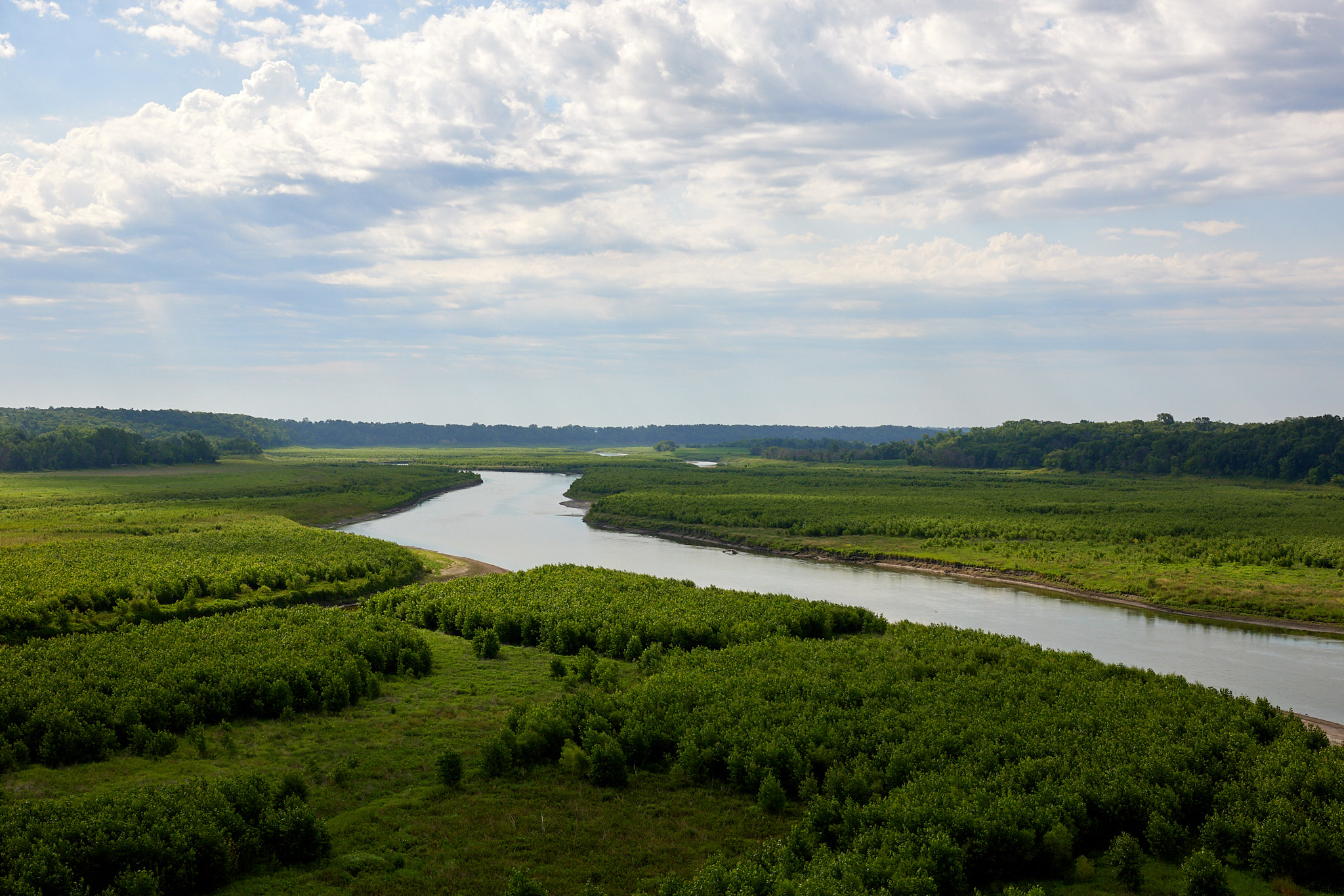
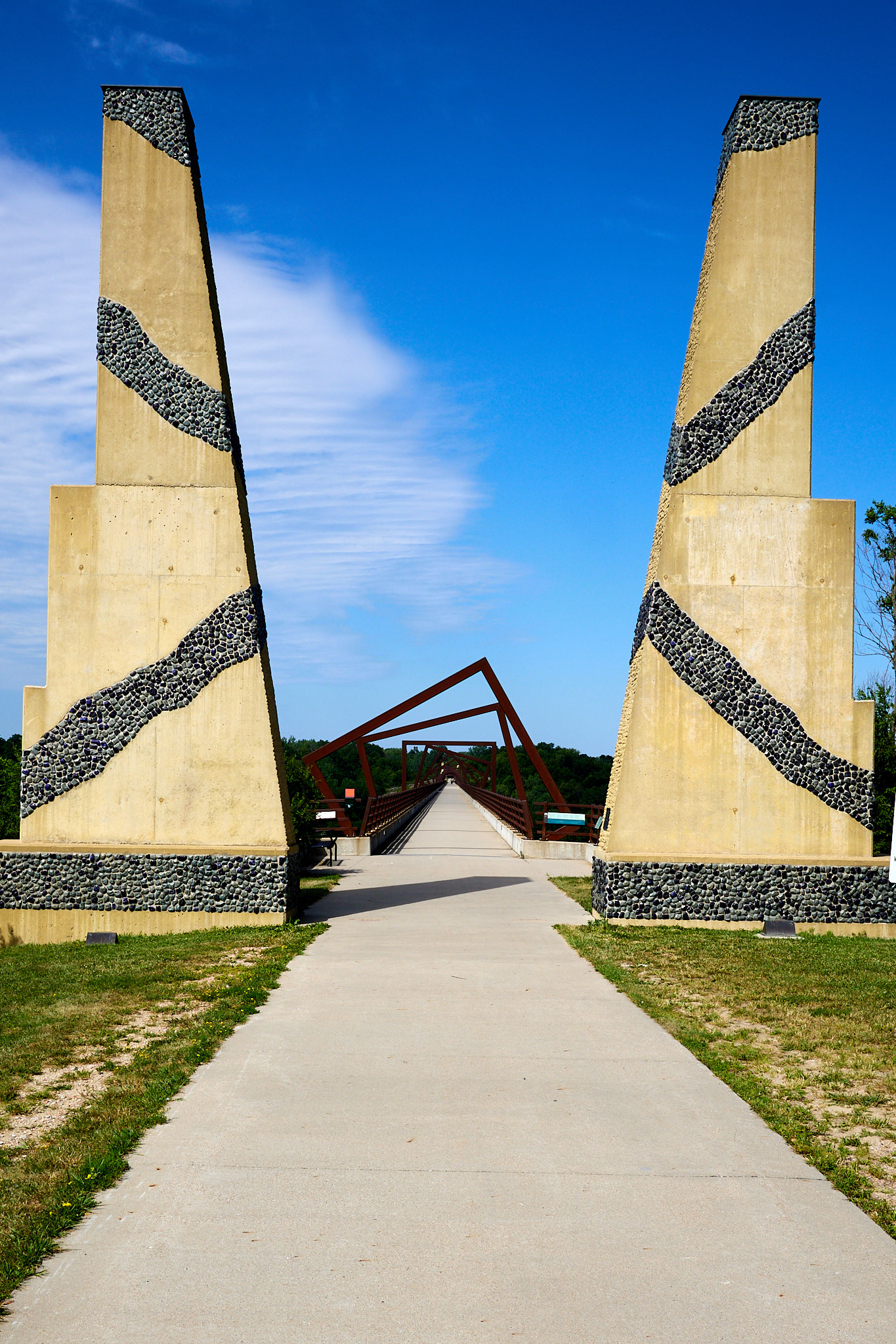
The High Trestle Bridge Trail is exactly what it sounds like: an old railroad bridge converted to a walking/biking trail, part of a rails-to-trails project. They actually didn't start with a railbed since the railroad took the steel beams to use on another bridge, but they did have the concrete supports in place. In fact some called it "Iowa's Stonehenge" before the trail was created. But eventually they built the new bridge and I think they did an awesome job on it. Not only does it have a great view of the Des Moines River, it also has an artistic flair of its own. Sadly I didn't get any pictures of it lit at night which is also really cool. This was a place I found on Atlas Obscura and added it as a chance to stretch our legs. We walked about 3 miles to the other side of the bridge and back. I'd also like to note that recumbent bikes are popular in Iowa.
The route through Iowa was designed to keep me away from Chicago because nobody wants to drive near Chicago. As a bonus I would get to see Iowa for the first time, but mainly it was to avoid traffic. This is where Google Maps let me down for the second time today. It decided that it could save five minutes by rerouting me from I-80 to I-88. Eventually both of them end up on the same road and skirt some of Chicago, but 88 gets a lot closer to the city and I ended up paying $5 just to see the five minutes evaporate due to an eight-minute slowdown. When we finally arrived at the Indiana Dunes National Park campground (Dunewood) I was tired and stressed. This was the worst driving I had done to date; way worse than around Denver.
Dunewood is a great campground. On the Mather Loop where we stayed the sites are nice pads in the trees and they are relatively private. The bathhouse has showers and a dish sink. It's about all you can hope for, and a nice location for the last night of the vacation.
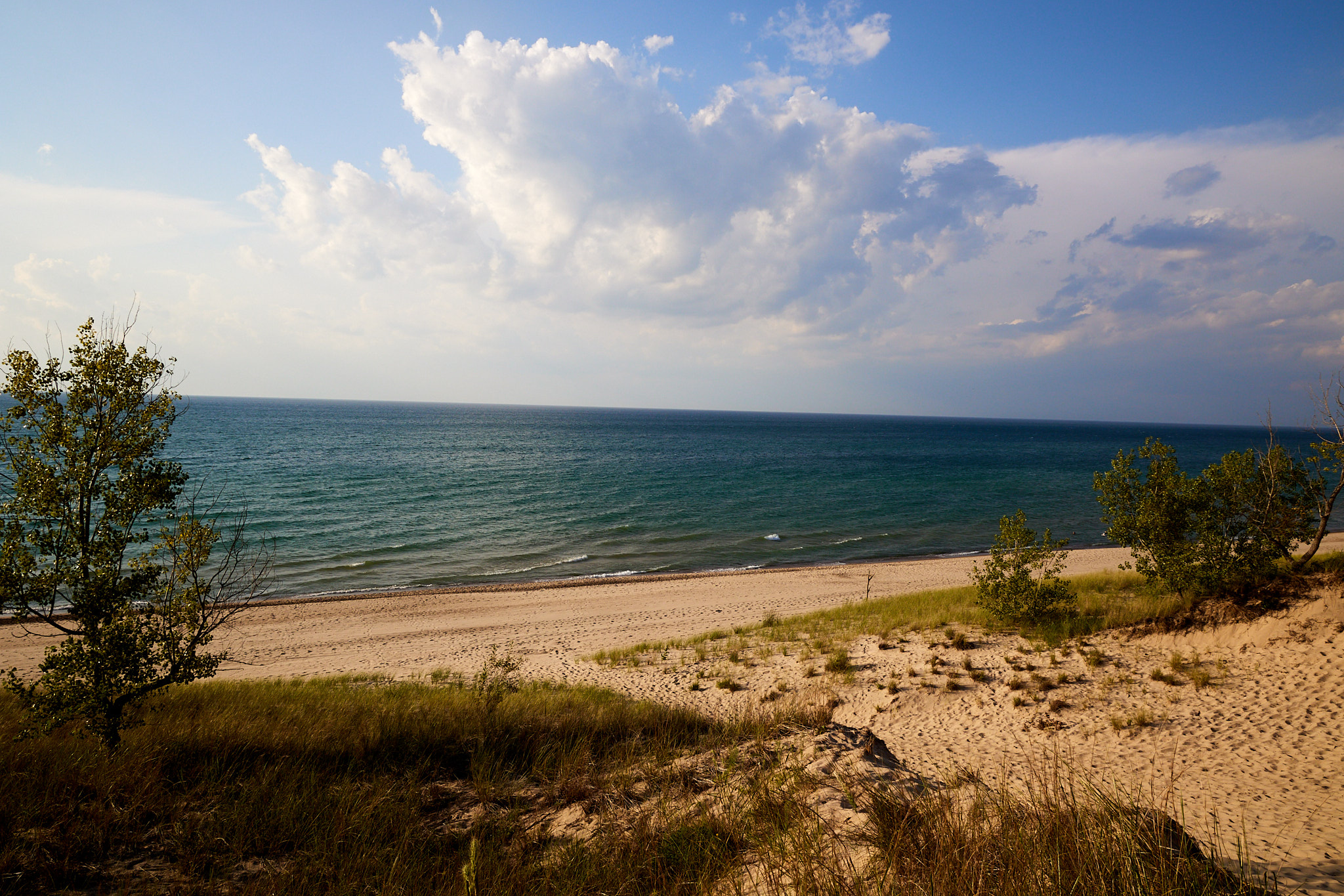
We decided to hike the dunes at Indiana Dunes State Park, heading out along the top of the dunes and then come back by the beach. Sand hiking is pretty hard especially up and down the dunes and it was late so we limited ourselves to two miles to make sure we had time to cook before dark. It was fun to be out by the water. The state park charges $12 for out-of-state cars but it is where the best dune and beach hikes are (and also where the crowds are).
Driving Distance: 515 miles
Hiking Distance: 5 miles