Little River Canyon / Desoto
2025-04-04
Fort Payne, AL
Today I headed off to Little River Canyon National Preserve and Desoto State Park (roughly adjacent) to look at some waterfalls. It was another short drive of an hour or so once I had packed up everything. I know that I am going to be in hotels for the next few days due to a combination of weather and locations, so I figured it would be easiest to roll up the mattress until it's needed again. Driving through Fort Payne (erroneously listed as having the world's largest frying pan which is in NC) is a real slice of small town America, at least down Main Street. I just glanced around as I drove through, but it looked very quaint.
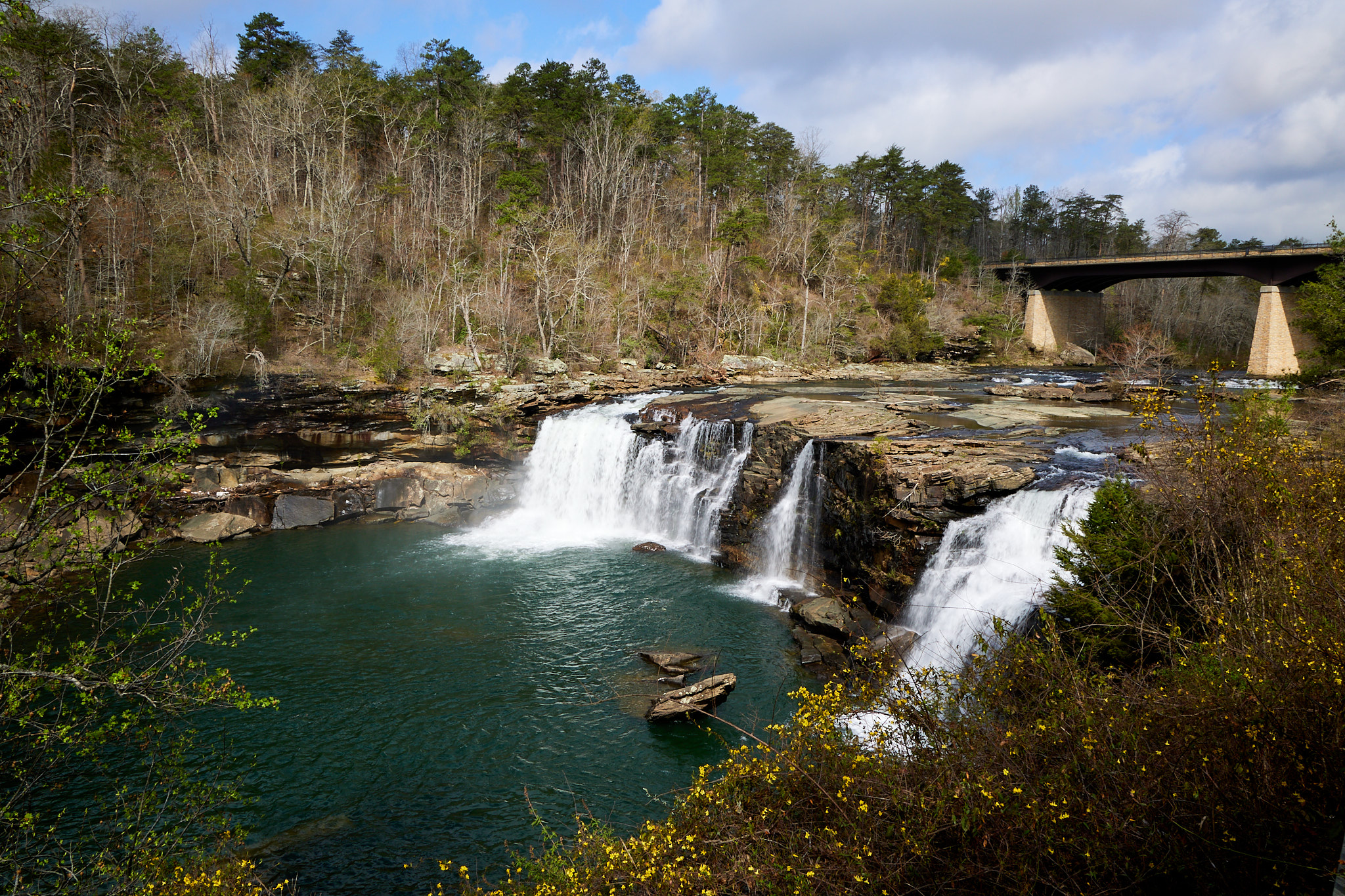
I started off at Little River Falls, which is easily accessible from a short boardwalk, but guarded by an extremely friendly volunteer who has been visiting the falls for 55 years. I learned a fair amount about his youth and a little about the mill that used to be on the river.
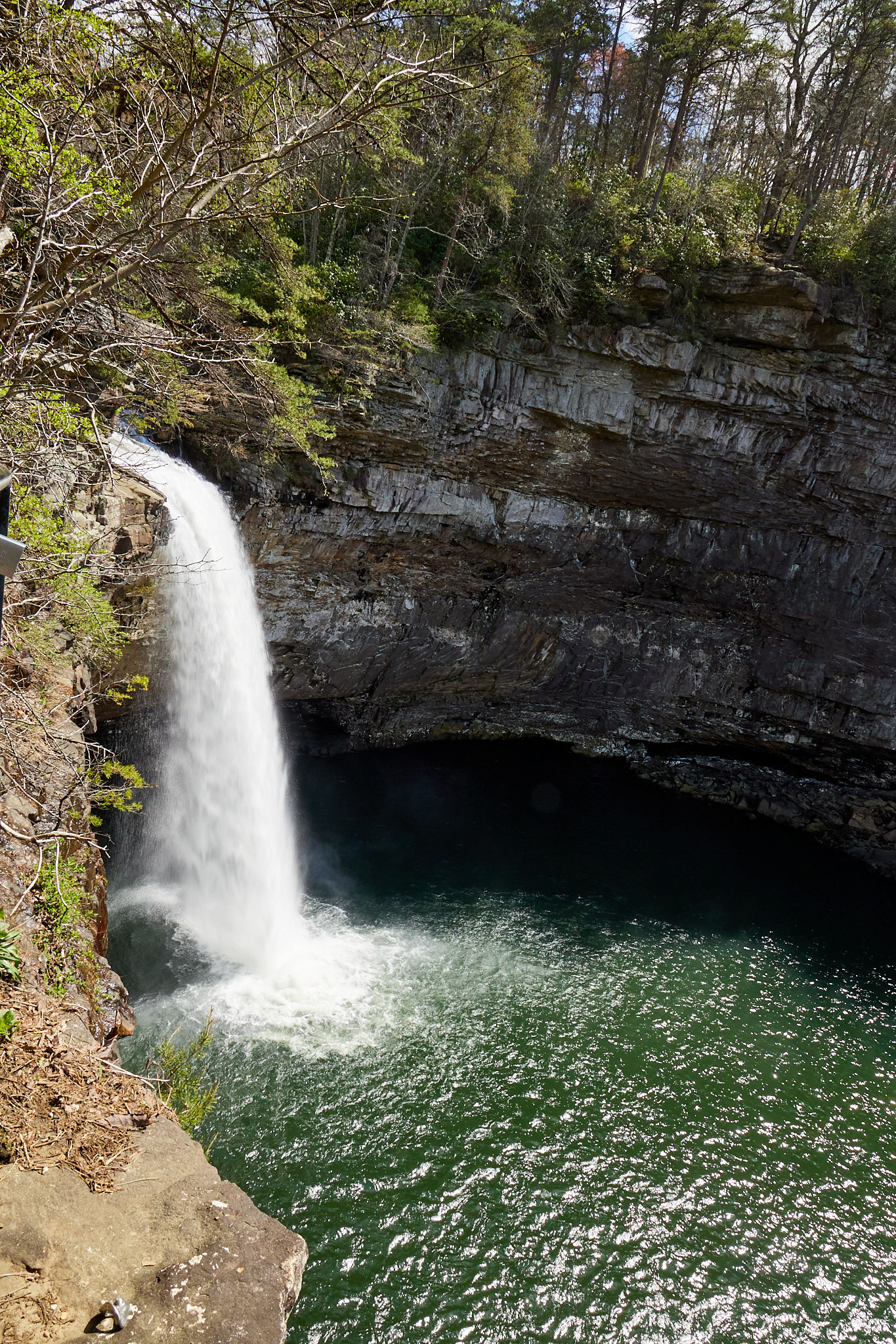
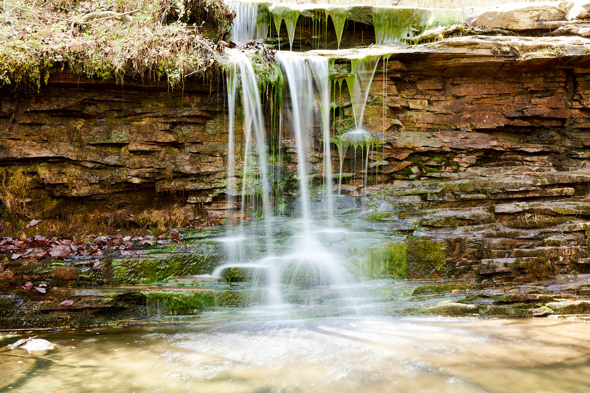
From there I took the trail down to Little Falls. It's only about 1.5 miles out and back. I took some extra camera gear, including a tripod and filters, because waterfalls can be challenging especially on a sunny day. I haven't been hiking much due to ankle issues and I haven't worn a pack in about a year, so this was a bit taxing. It also shows why good photographers start with a scouting mission. The tripod would have helped today, except you couldn't go any further down the river on this side; it was vertical walls. To get in front of the falls and take the shot, I needed a dry bag and water shoes for crossing the river safely. I had these in the car, but I had other stuff to see so I didn't hike back down to go the extra distance.
Next I tried Laurel Falls and Lost Falls, which was closer to 2.5 miles as a loop. I again packed my tripod, but when I got to Laurel Falls I found that it was a top view. I cannot really capture a vision of a waterfall from the top, and I didn't even try today. It was 85 degrees by now and my lack of training includes not hiking at anything warmer than 68 degrees because, in PA, that's the warmest you get this time of year. But I pressed on to Lost Falls, which was a ways up the mountain. It's small, but pretty. And this time I did get to use the tripod I carried all this way.
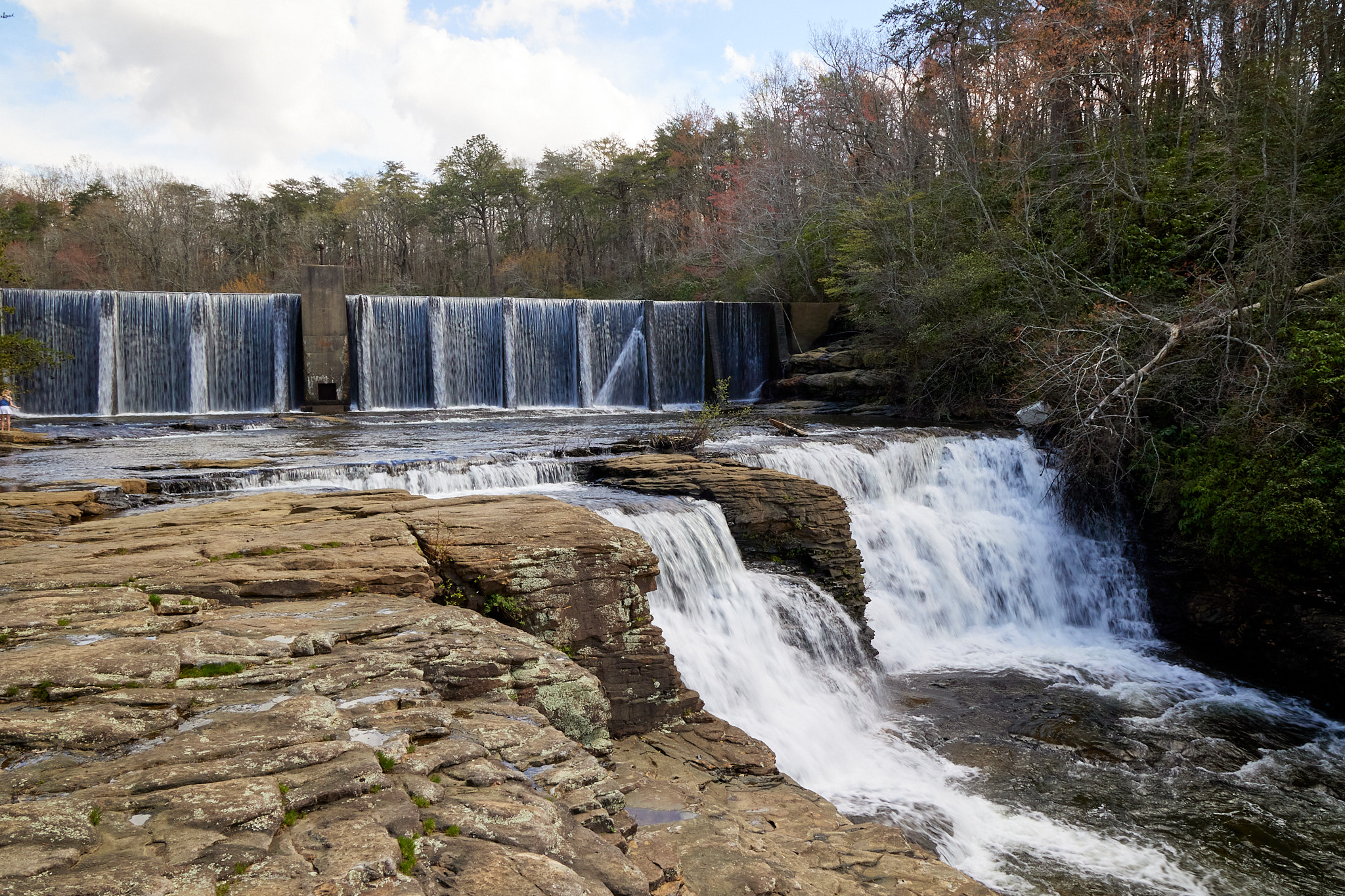
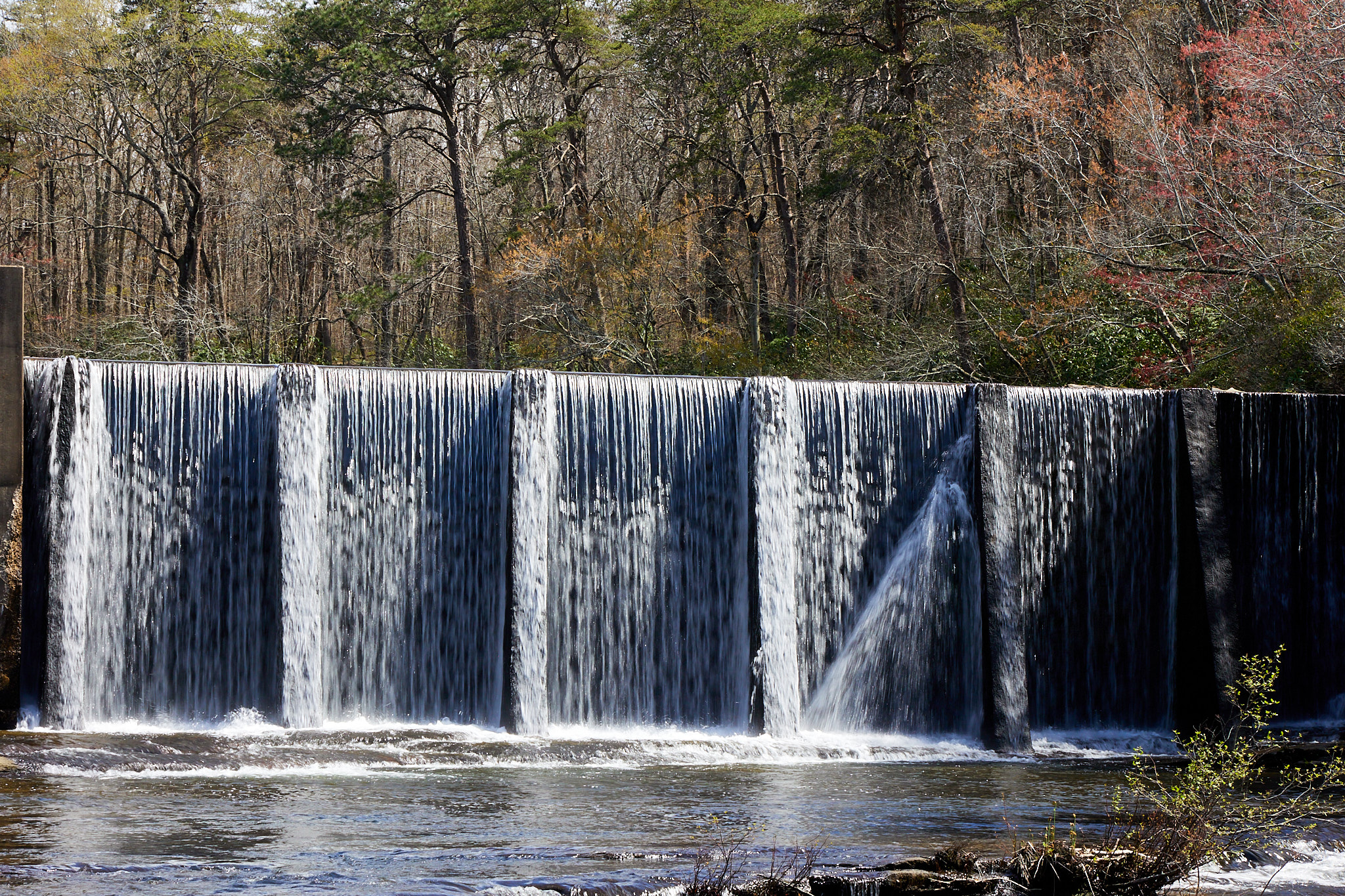
The return trip was much easier. Downhill can have that effect on a hike. It was really hot in the sun, so I even treated myself to a cold beverage at the park market which was right next to the trail. Then it was off to Desoto Falls. It seems like the park is named for the falls, and the park does own the falls, but it's like 10 miles away from the park. Google wasn't fooled though and I got to check it out. The falls is actually in three layers. The top level is a dam, and it's designed to spill over the top. It was hydroelectric in 1925 but now it's too small for Big Power.
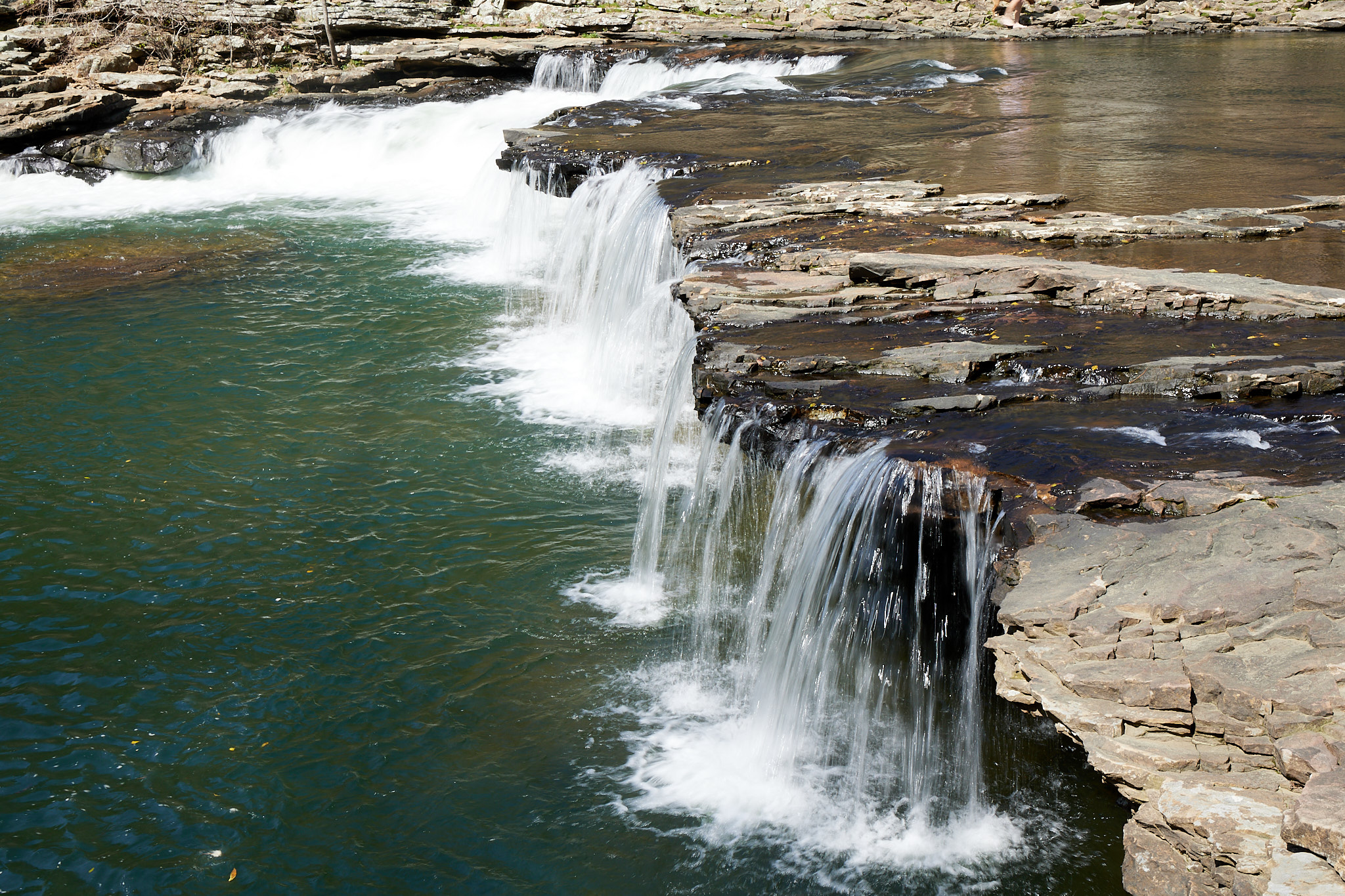
The next two falls appear natural, with the upper being broad and the lower being narrow. That makes the lower one seem to move a lot more water, although we all know that there is the same amount of water flowing over all three falls.