Natchez Trace
2025-04-11
MS
I started off the day with a walk to Fort Rosalie, which google assured me was only a few blocks from the hotel. When I got there, I found just a log building that was the gift shop from a haphazard recreation done in the 1940's. Apparently I missed the real "fort," which is currently a bit of split rail fencing, five descriptive panels, and some picnic tables. I'm calling that a google fail that had very low consequences.
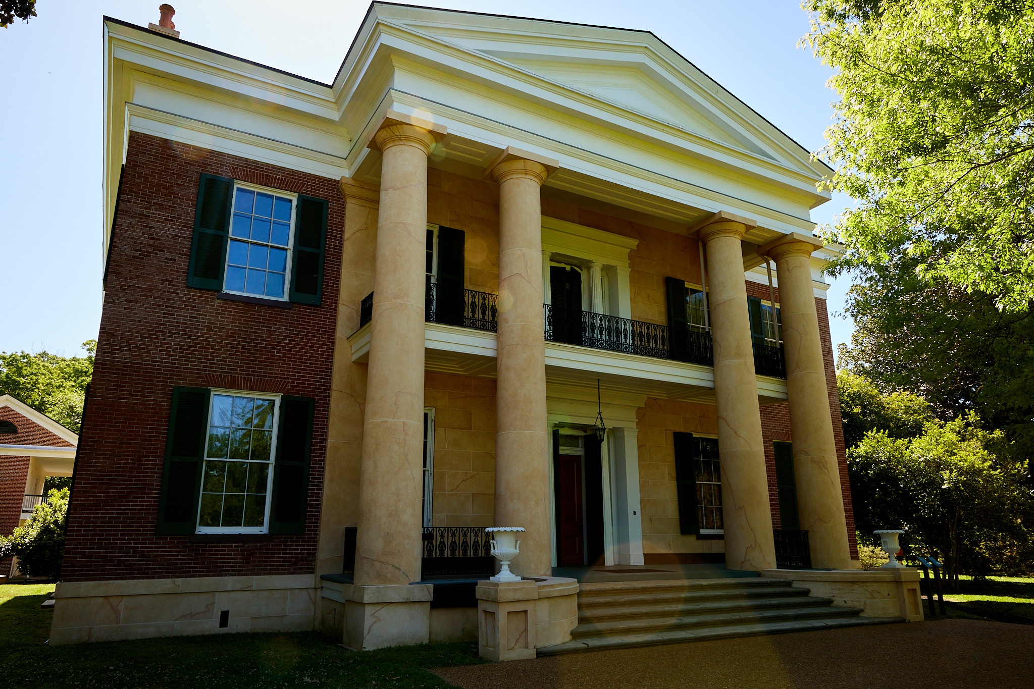
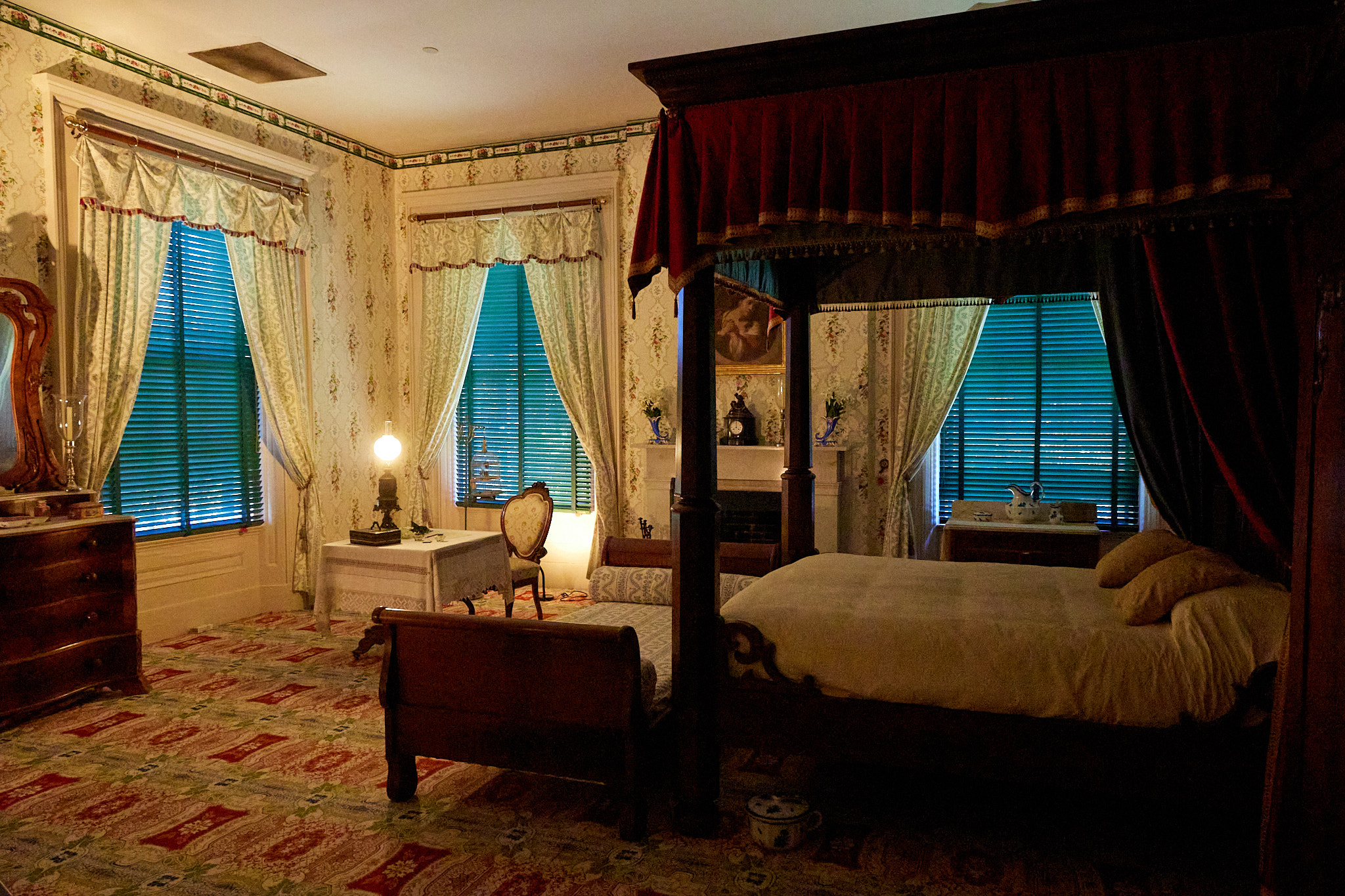
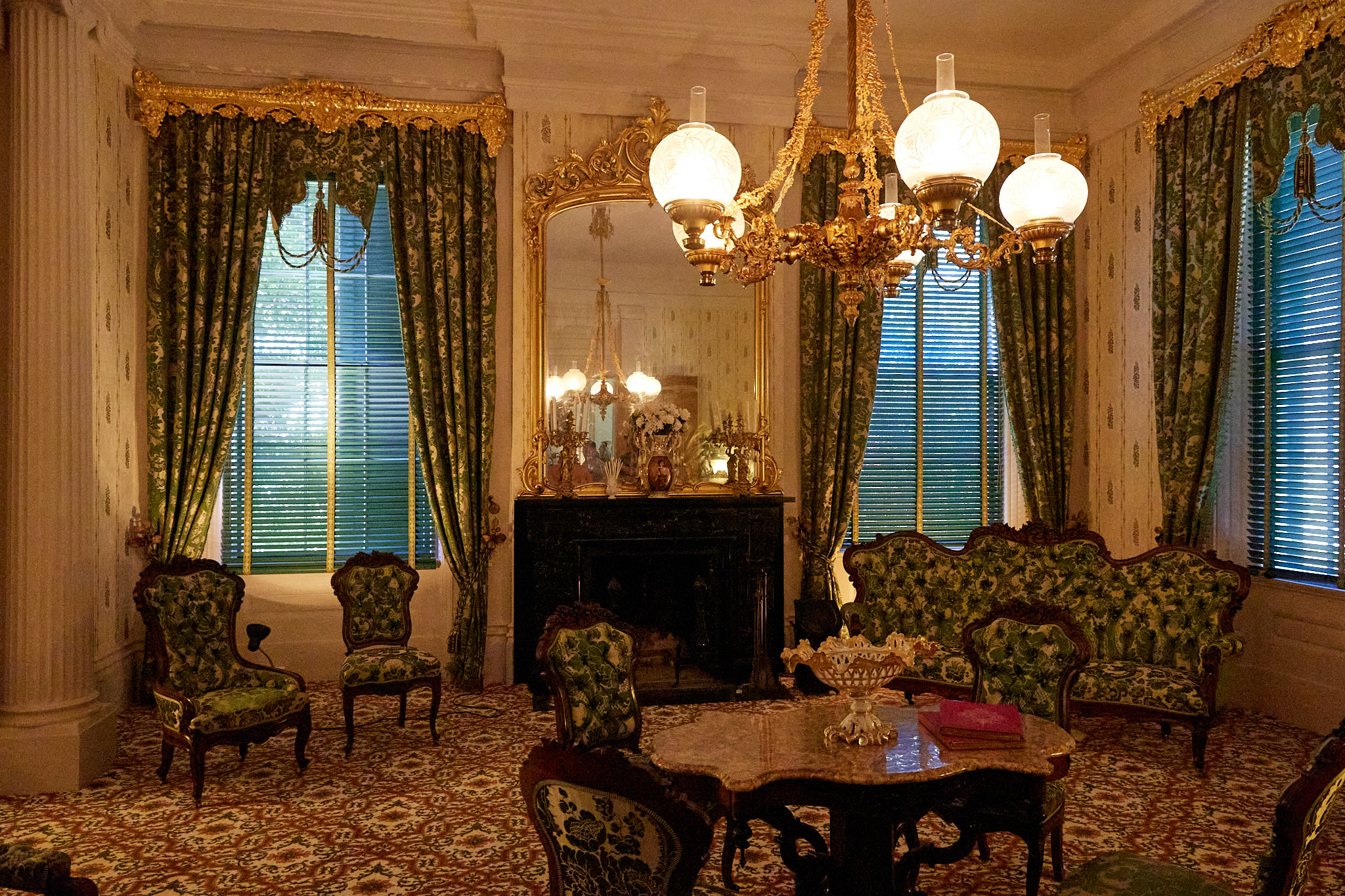
My tour of the Melrose Mansion was scheduled for 10:00 AM, so I wandered over there a bit early and poked around until the tour started. It's weird to think that the Melrose family would have been lost to history if the house they built wasn't bought by the National Park Service. The basic story is that they owned some plantations, decided to build the mansion, lived there a while although they would escape the heat of summer and just leave the slaves to deal with growing and canning vegetables for the rest of the year. They ended up owing a lot of money after the Civil War, so they sold this property which luckily had caretakers for many years while the new owners kept it as-is, and then restoration-minded owners worked to restore it. The house is about 90% original including the furnishings.
Next I started on the Natchez Trace Parkway. The original Trace was a path from roughly where Nashville is to the Mississippi River at Natchez. It was heavily used in the years before the railroad, but dates back thousands of years where Native Americans used it as well.
The parkway is a two-lane road that has plenty of dashed-line passing sections which I used twice for cars and about a dozen times for bikes. The drive is easy because the traffic is light, and no commercial vehicles are allowed so you don't get stuck behind a truck (but RV's can still slow your day). Furthermore, it has overpasses or underpasses for roads of any size, and while there are a number of smaller crossroads, the parkway always has the right of way. The view is bucolic if consistent; 5-30 yards of grass on either side of the parkway and then the woods start. Occasionally there's a field or a lake.
The Parkway has dozens of pull-outs. There are Indian Mounds, Scenic Overlooks, Historical Sites, Nature Trails, comfort facilities, and so forth. I didn't think it was practical to stop at every one, so I had worked out a list of a couple dozen places I wanted to stop based on other people's lists.
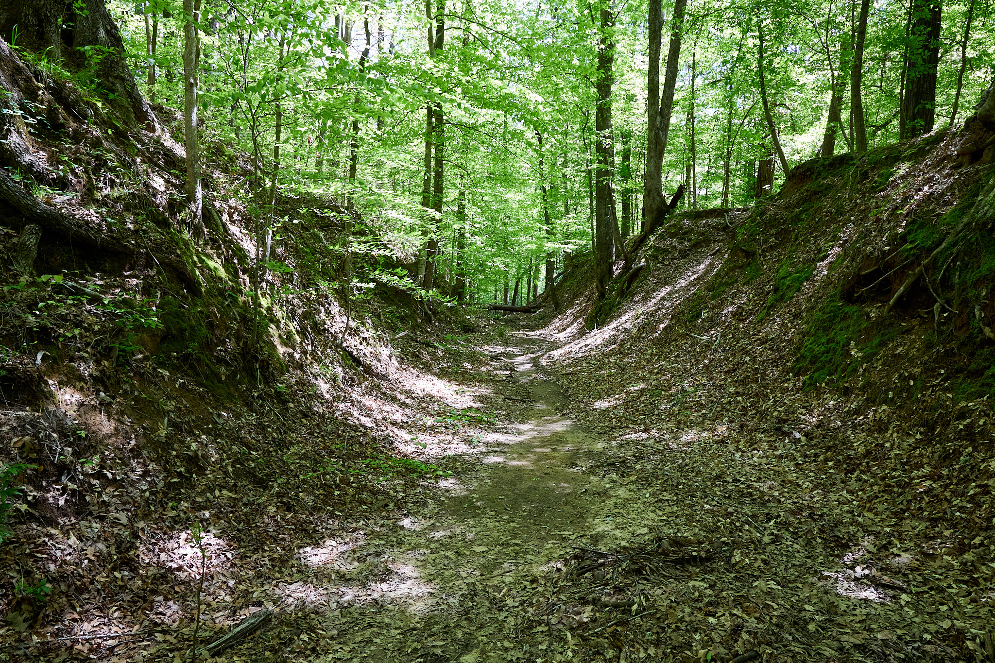
I stopped at a "Sunken Trace" which is a piece of the original trail that you can walk. Of the years it eroded to be about ten feet deep. I have often said that paths double for washes and vice versa, but the magnitude of this was surprising. I guess in the winter you were happy to be out of the wind, while in the summer you hated the fact you were out of the wind...
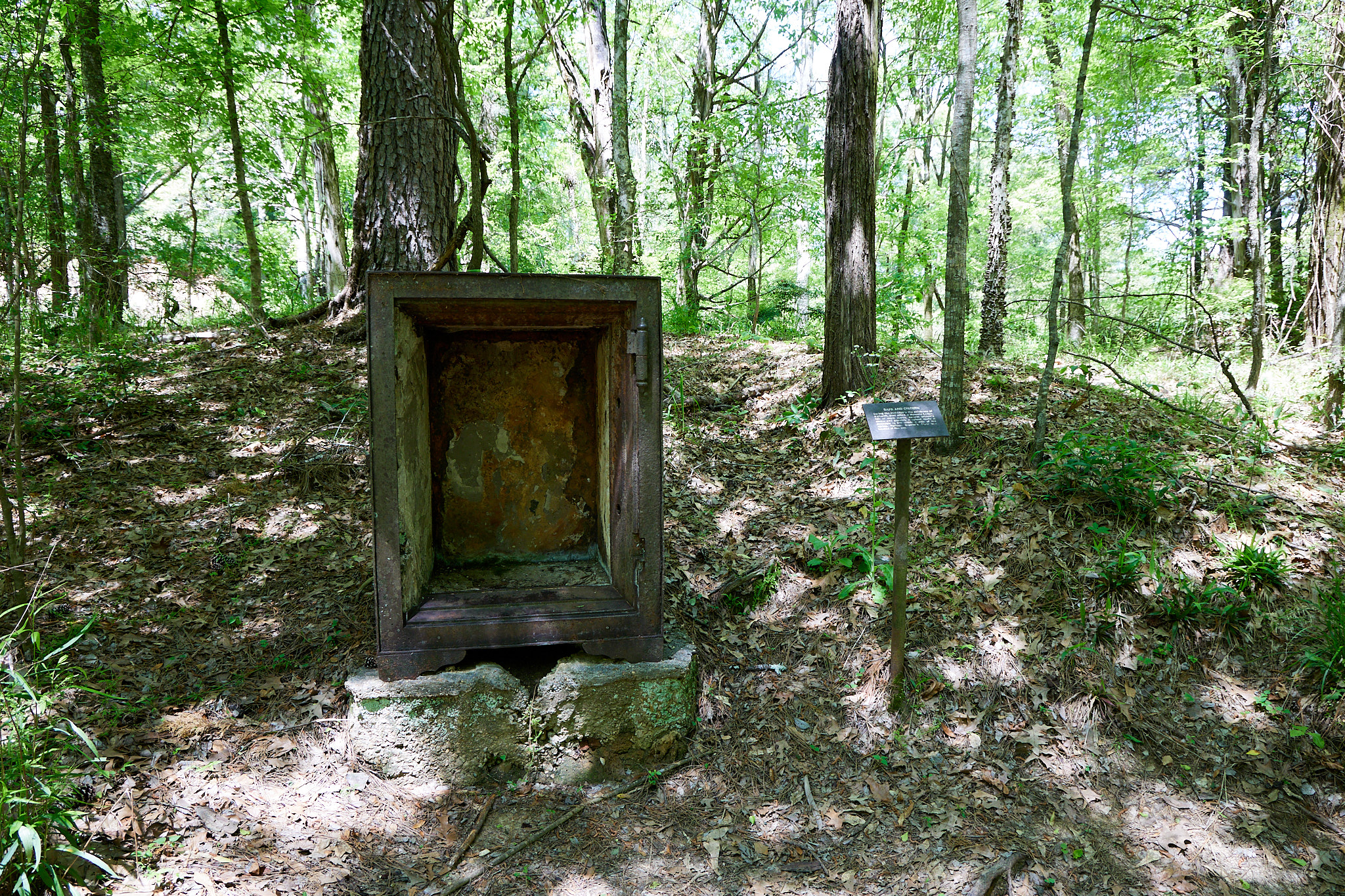
Another stop was at the former trace town of Rocky Springs. All that's left is a couple safes and a few cisterns. It was a case of death by a thousand cuts - bad farming practices, yellow fever, the civil war and loss of slaves, etc.
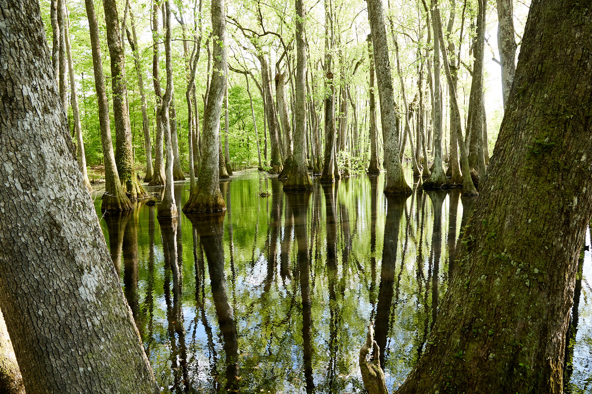
Another nature walk took me around this cypress swamp. It was a lovely break.
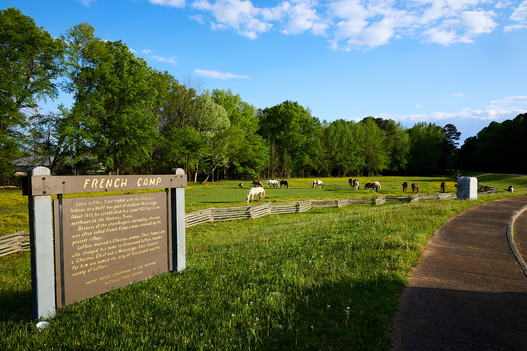
I stopped at French Camp as one of the Historical Sites. In this case, it is just a sign telling you a French guy sold stuff here at one point, and through deduction I determined that sometime since then it has become a horse pasture.
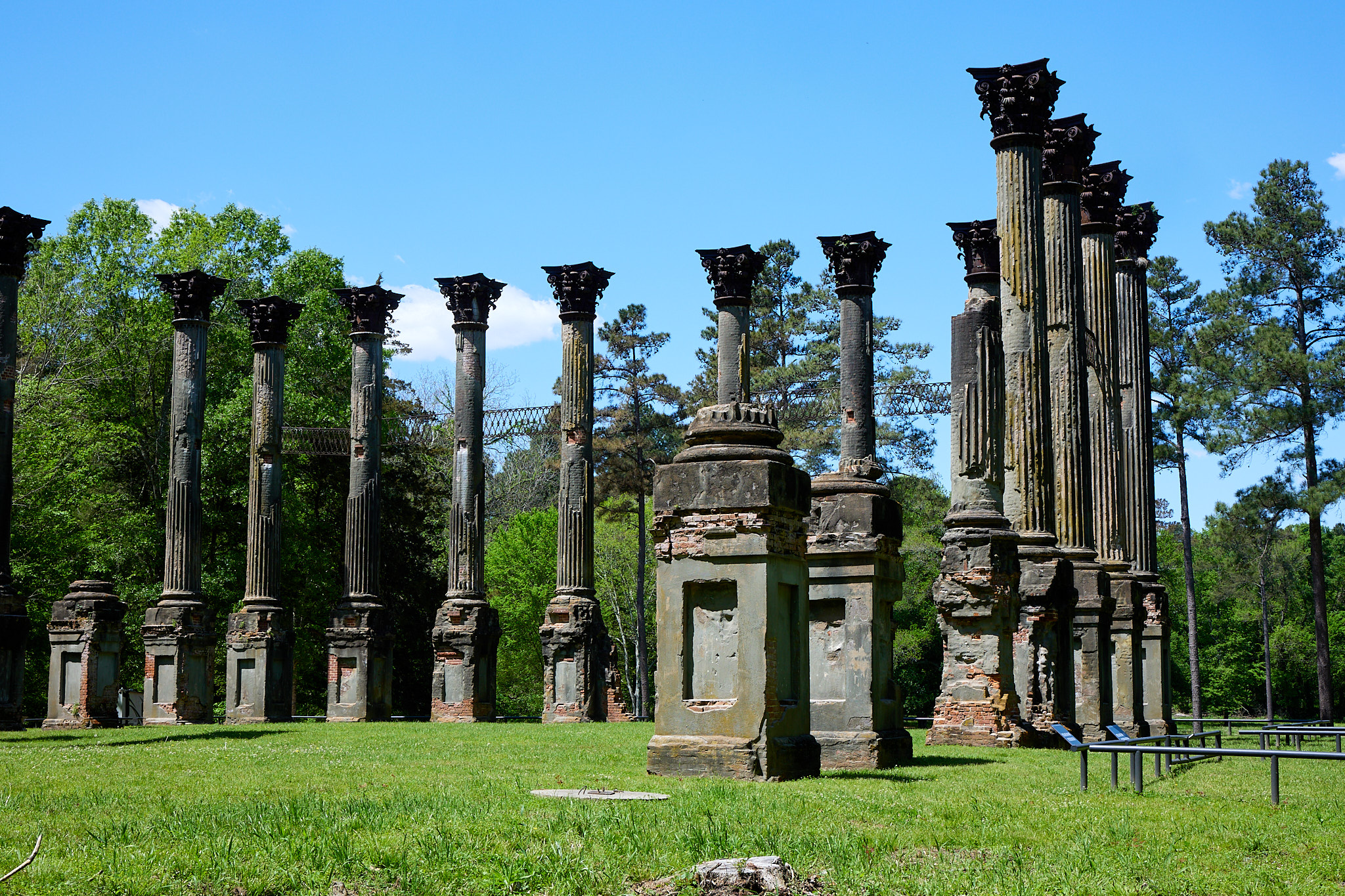
Some of my adventures took me a little further afield. At that point you start to do mental math about the predicted value of something you haven't seen divided by the distance from the trail and try to guess whether to go there. The Windsor Ruins are about 11 miles off the trail, but worked out to be worth it for me. They are just the remaining columns from a pre-war house that burned down in 1890. The columns are topped with iron Corinthian capitals. The brick columns were covered in stucco, and I wouldn't be surprised if they were painted to look like marble. That seemed to be the style back then.
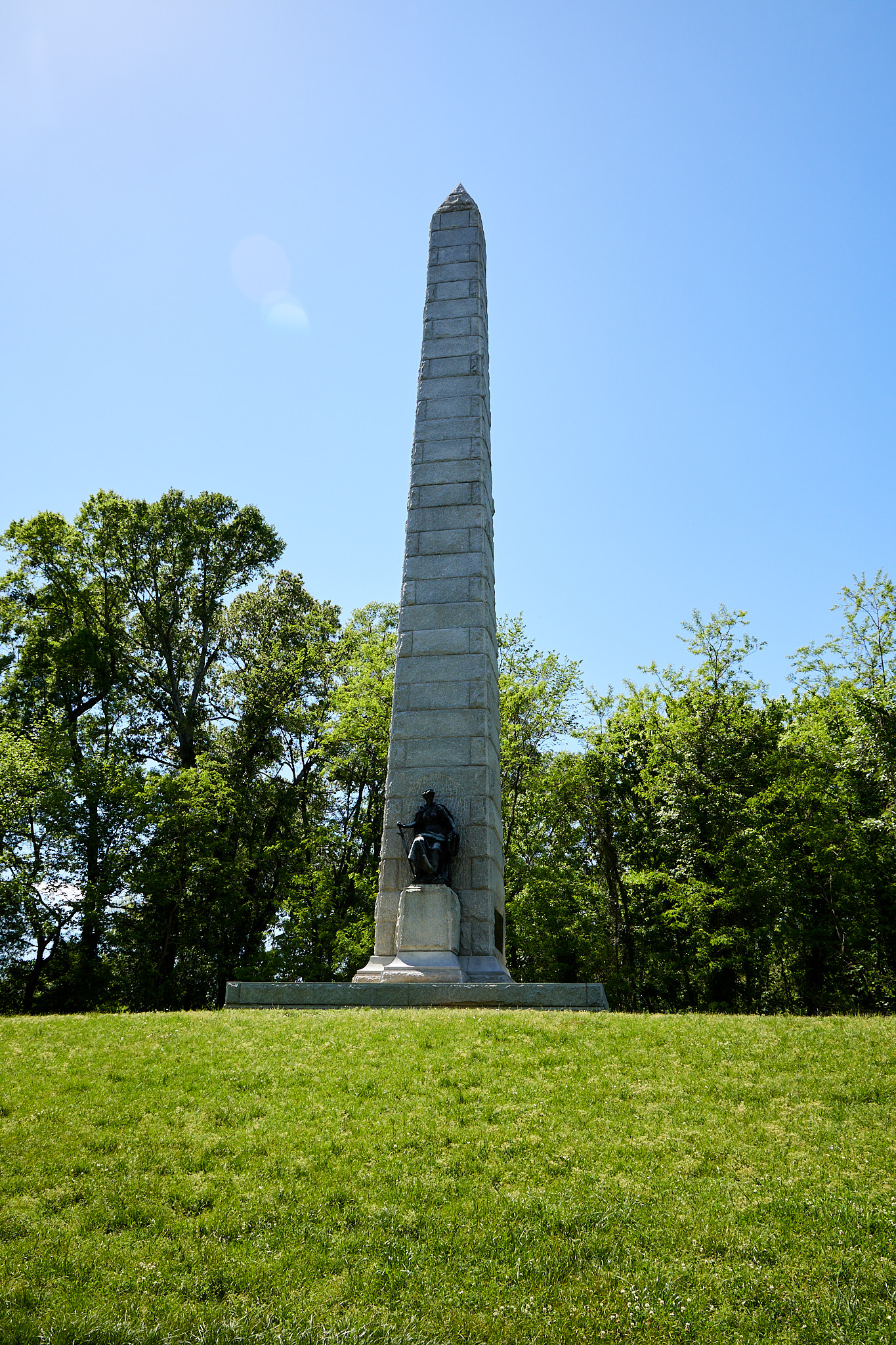
A bit further afield was the Vicksburg National Military Park. This was maybe 30 or so minutes away from the trace. Military Parks are similar to Gettysburg. There are lots of fields full of obelisks, ranging from tiny to towering, that commemorate the brave men who fought there. There are also a number of plaques supplying information.
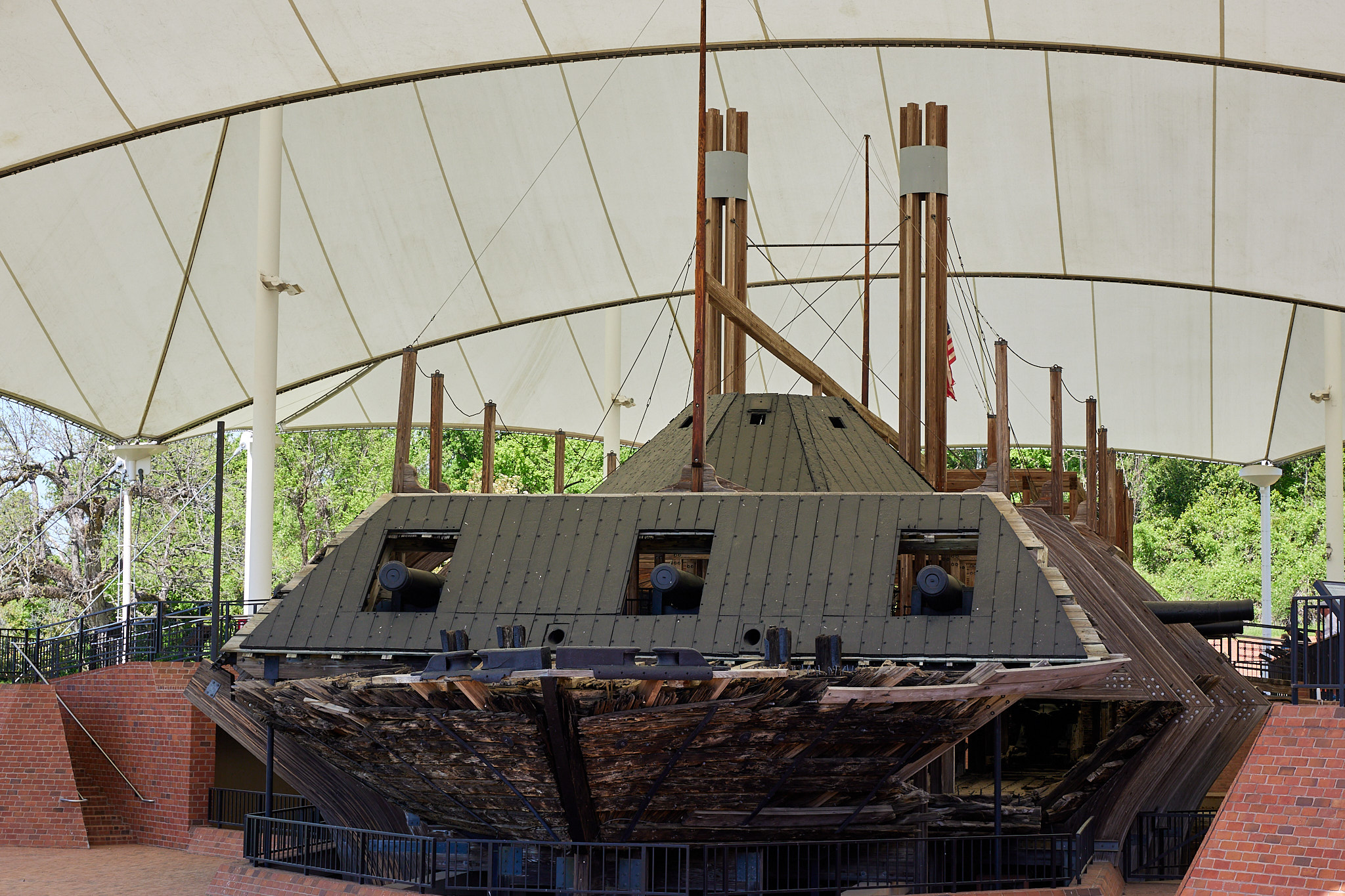
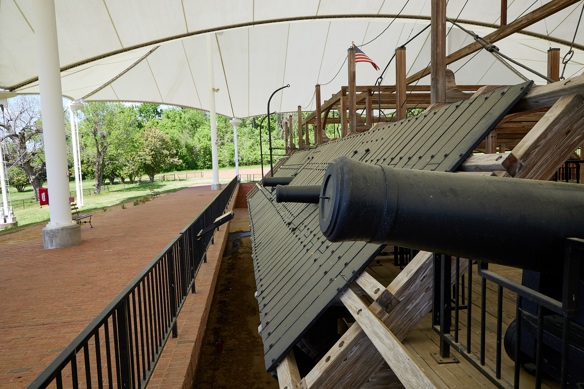
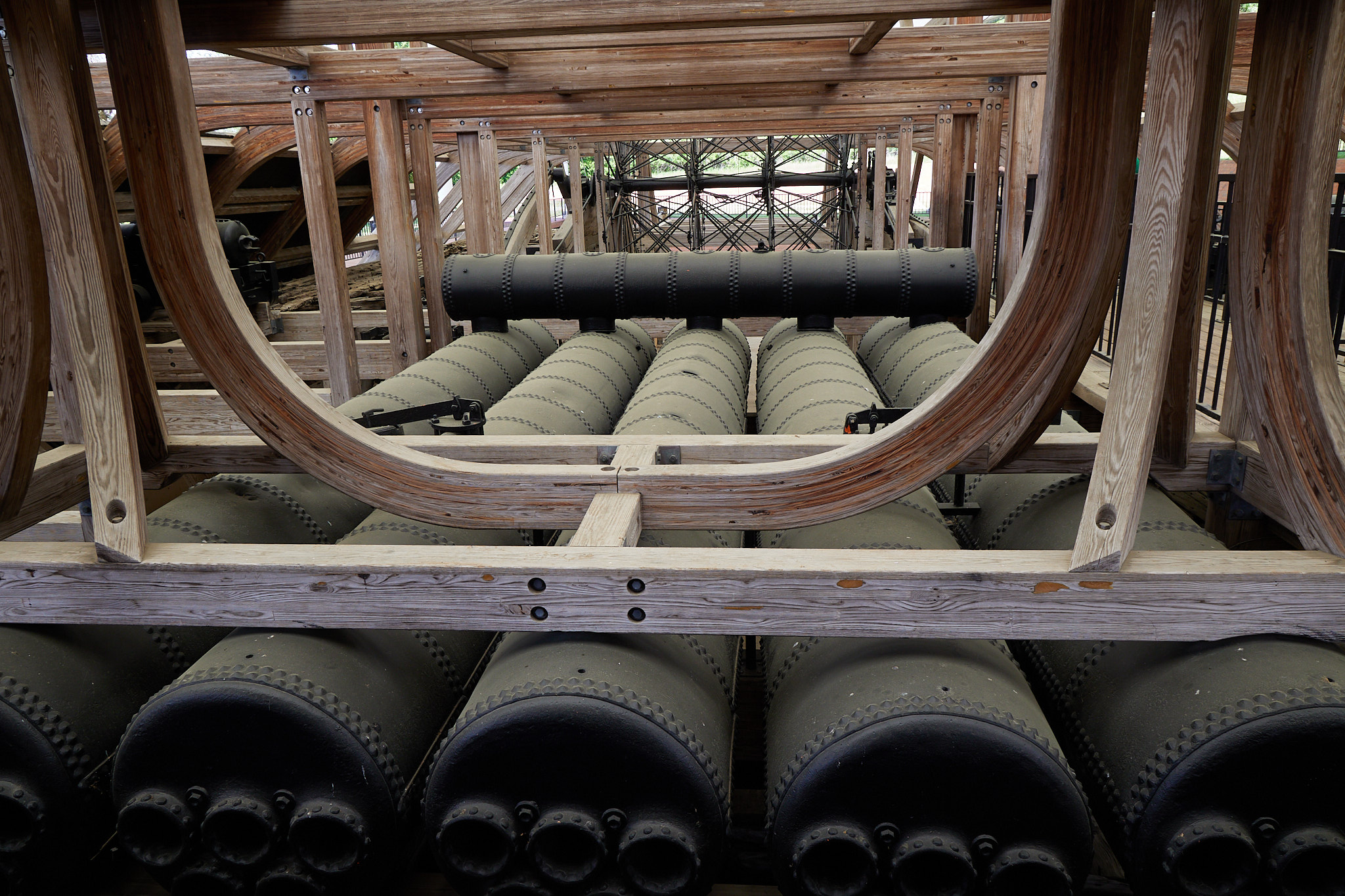
Mainly it's a driving tour with a small visitor center. That wouldn't have been enough to make me detour. However, tucked in the back, they have a real ironclad. The Cairo was sunk by a mine in a nearby river, and a few decades ago they salvaged it and put it on display here. I don't know if you think that's as cool as I do, but then since you're likely just my future self rereading this, you probably do.
My plans to camp tonight have been thwarted again by the weather. This time it's a cold snap, getting down to 40 and maybe below. It's going to last a few days so I'll keep room hopping. The hotels in Stark would have been perfect but they are all booked for some reason so I drove up to Tupelo where I was able to readily procure lodging. It's the weekend I guess.