Monument Valley of the Gods
2025-09-06
Monument Valley AZ and Valley of the Gods UT
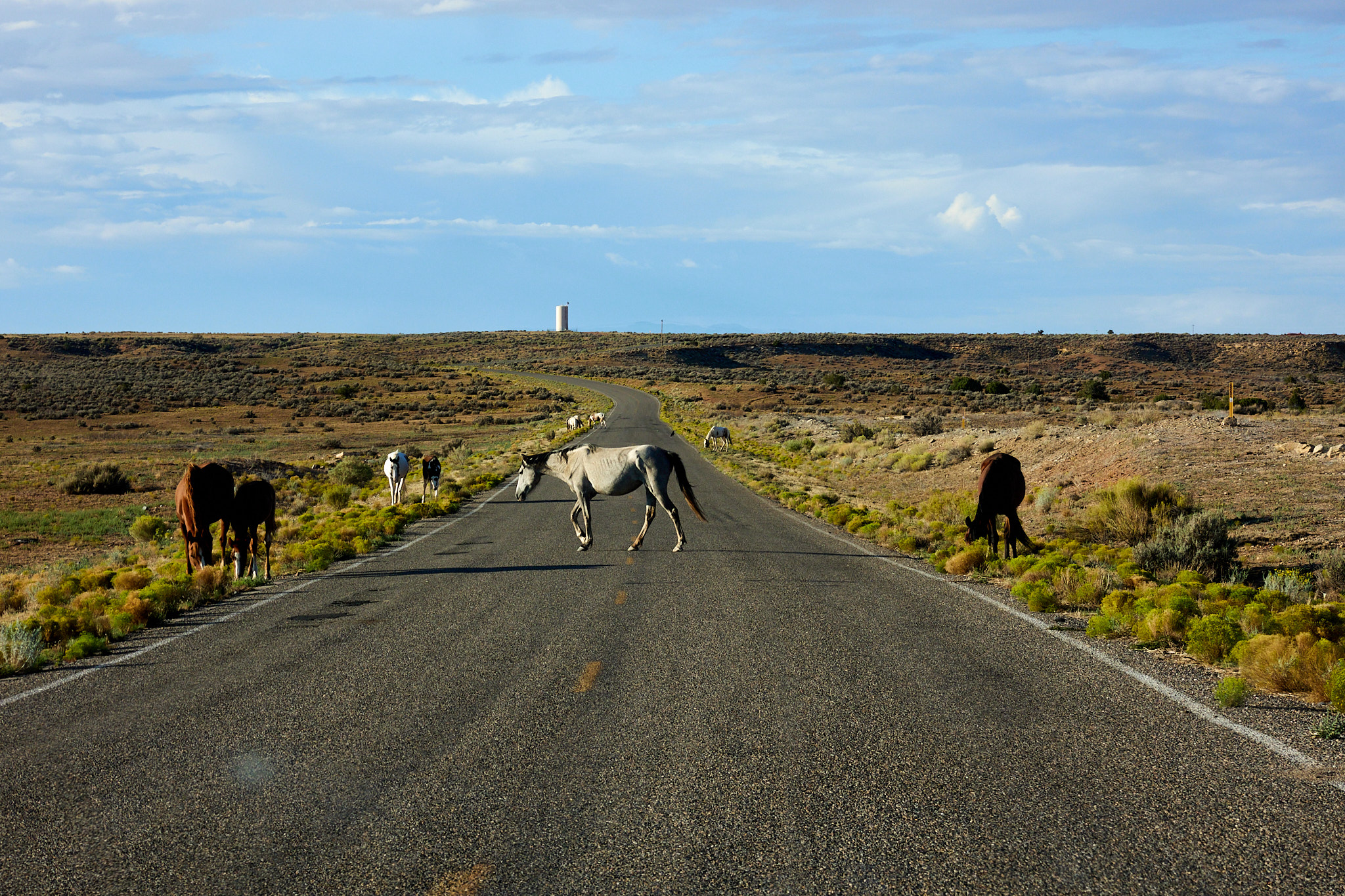
In this section of country, they have what the call "Open Range" roads. On these sections of road there are no fences and the cows or horses are free to eat at the side of the road or cross it when they choose. It beats mowing in my opinion. I guess it's essentially the same system we have for deer in Pennsylvania, although no cow will jump out of the trees at the side of the road. Or jump out of a cake for that matter, although that would make a delightful treat for your favorite farmer friend.
I bring this up because I saw horses on the road just as I was leaving the National Monument. This was unusual enough to me that I took some pictures. I hadn't seen any free range animals at the road. However, in the next hour I saw horses ranging twice more. After the first ones I didn't take any more pictures because then they're mundane. I don't know who owns them or how or when they get rounded up; none of that happened on my watch.
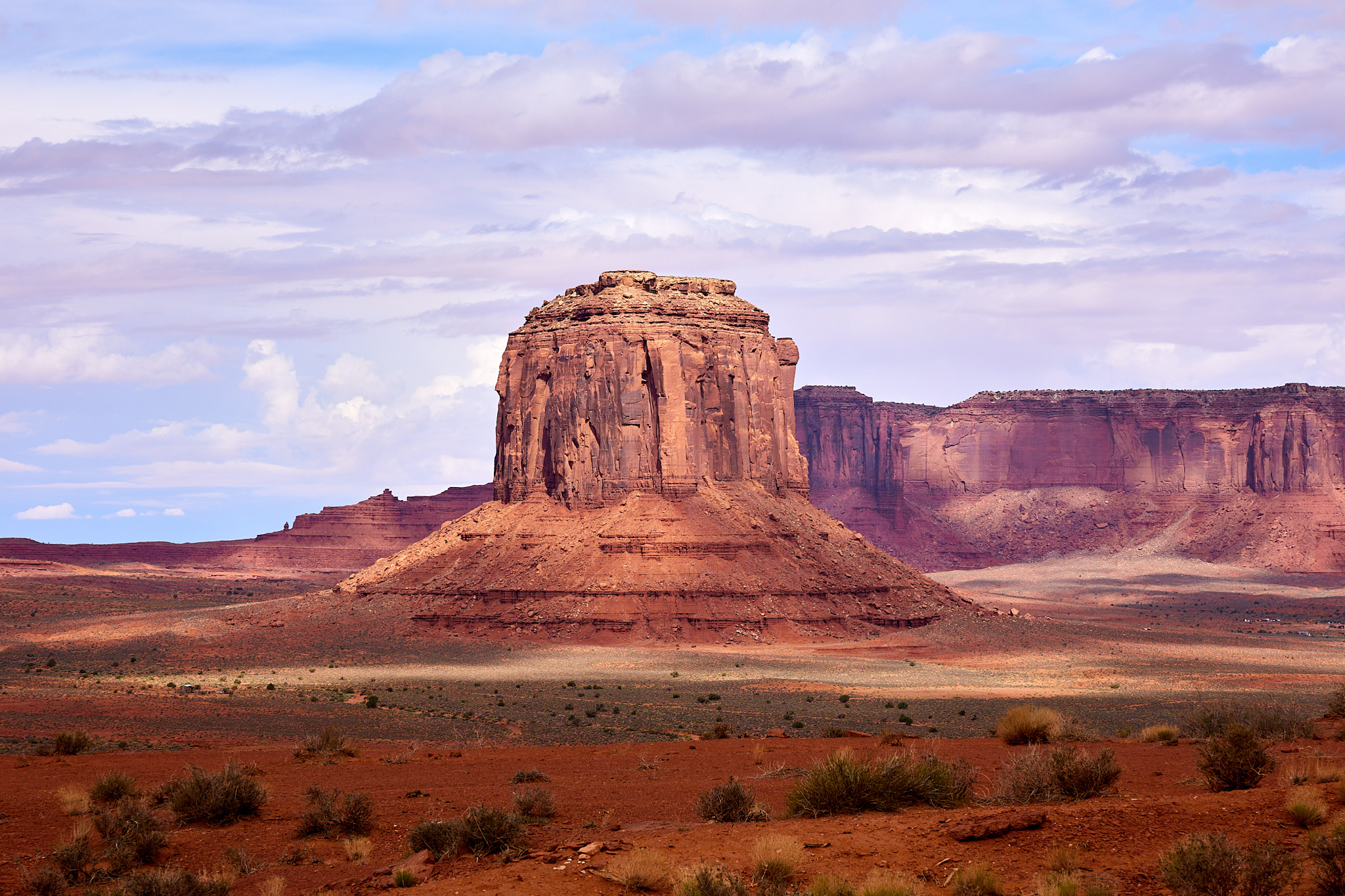
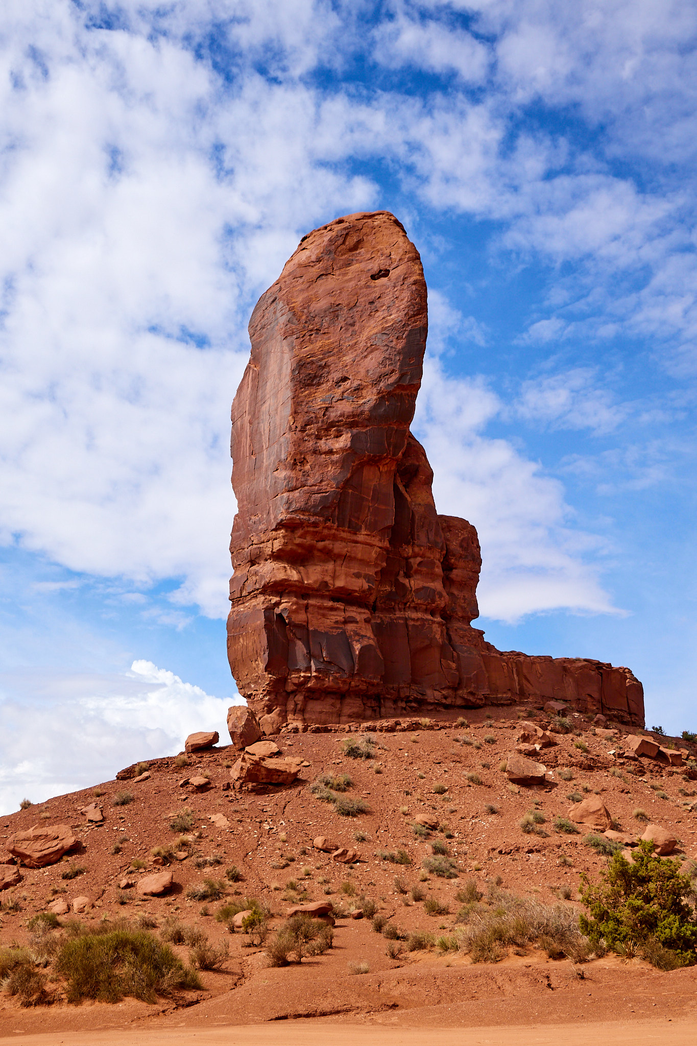
The first stop was Monument Valley on the Navajo Nation. It took a couple hours to get there, and it was still raining as I arrived. I stalled by visiting the Navajo welcome center which has a few historical displays. This is different than the Monument Valley Visitor Center, which is shops and tours and restaurant and other ways for you to spend money. The prime attraction is a scenic driving loop on the valley floor. It's 17 miles long that takes 60-90 minutes and you can either drive your car or take a tour in a truck. If you're driving a Porsche, I recommend the tour. Of course I had to try it in my borderline off-road capable vehicle. The road was extremely rough and I used my Outback's high clearance a lot and X-mode a little. The latter is the gizmo that gets more traction to all the wheels, making AWD behave a little more like 4WD.
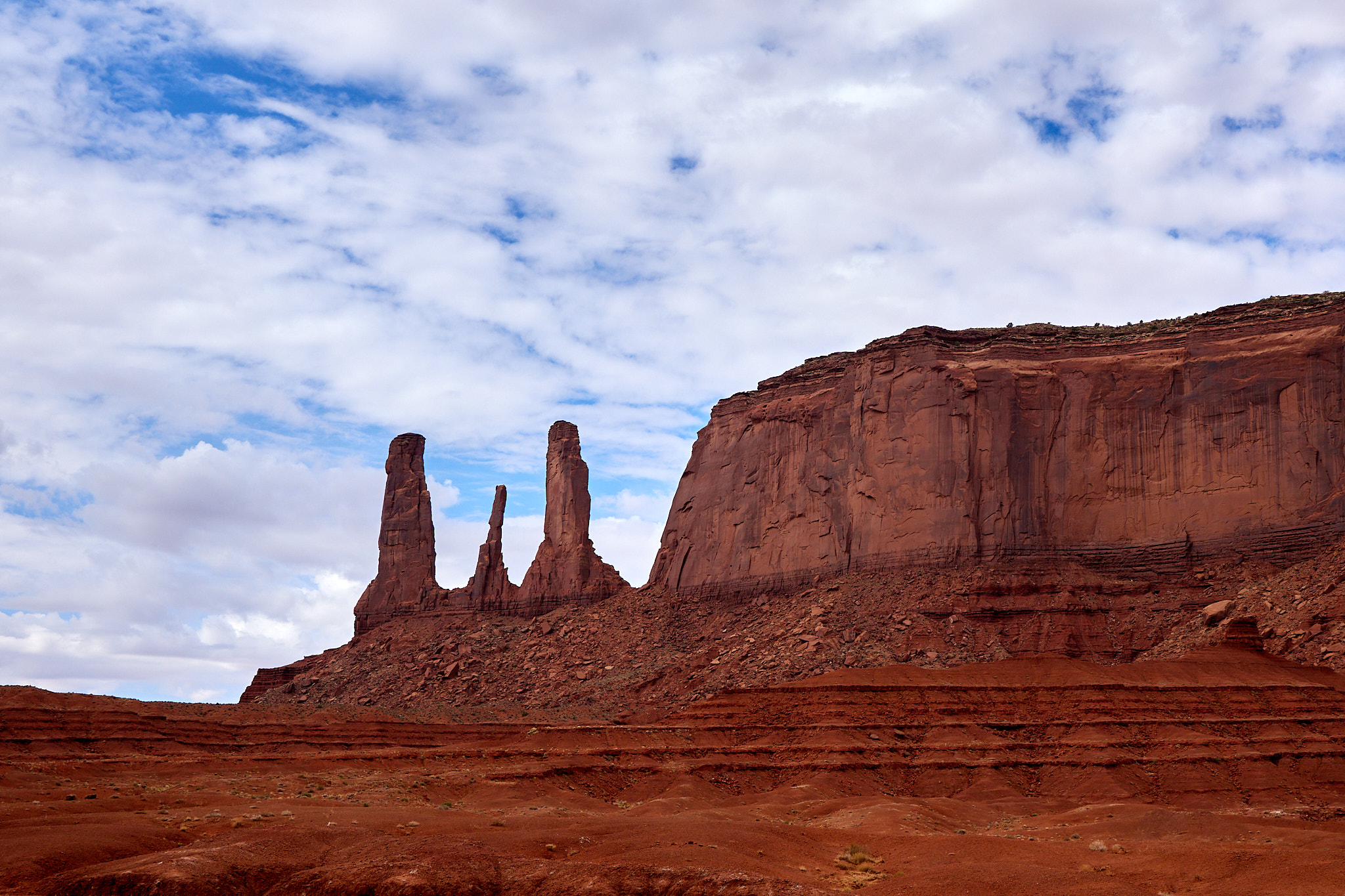
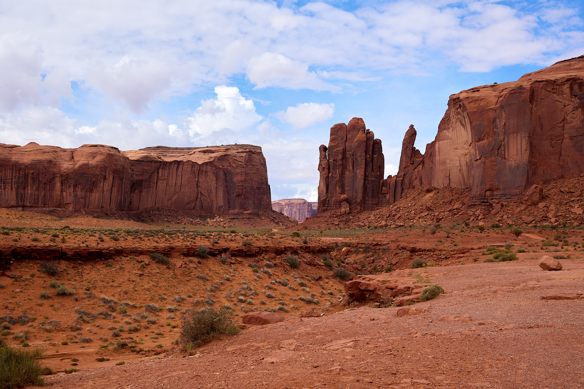
The weather started off overcast but the light improved as time went by so my later photos are better. But a gray background is better than not seeing them at all. The scenery is really spectacular and I think this is definitely a good use of your time. Some of those buttes were beauts! (I'm sure I'm the first one to make that joke...)
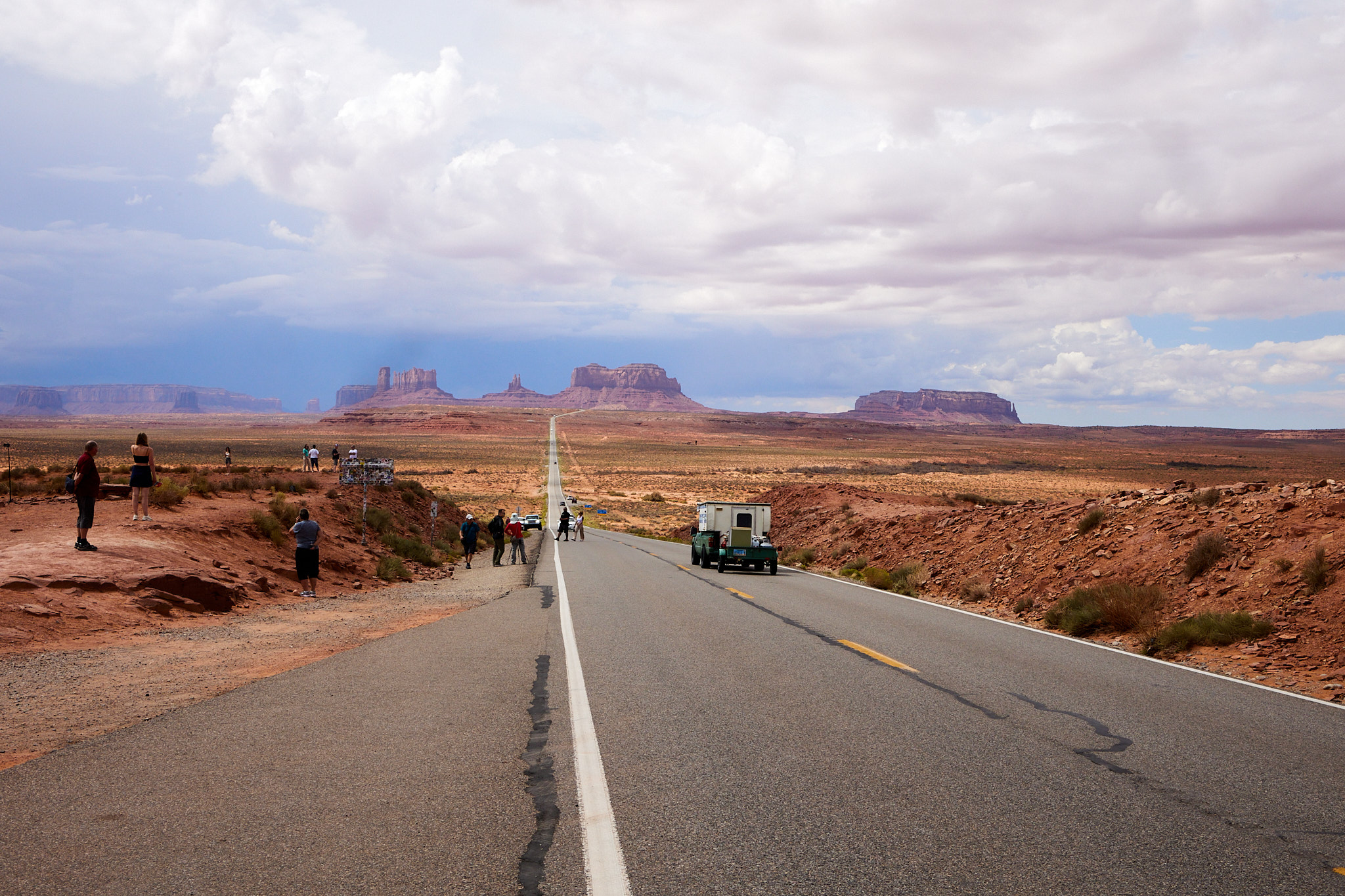
There is a four mile hike from the visitor center that I was planning to do, but the driving left me exhausted mentally and physically so I headed off. Leaving Monument Valley there are a lot of scenic pullouts on the highway. There's a sign proclaiming Forrest Gump Point which - and I had to look this up - is the point where he ends his run in the movie. It was a bit more crowded today.
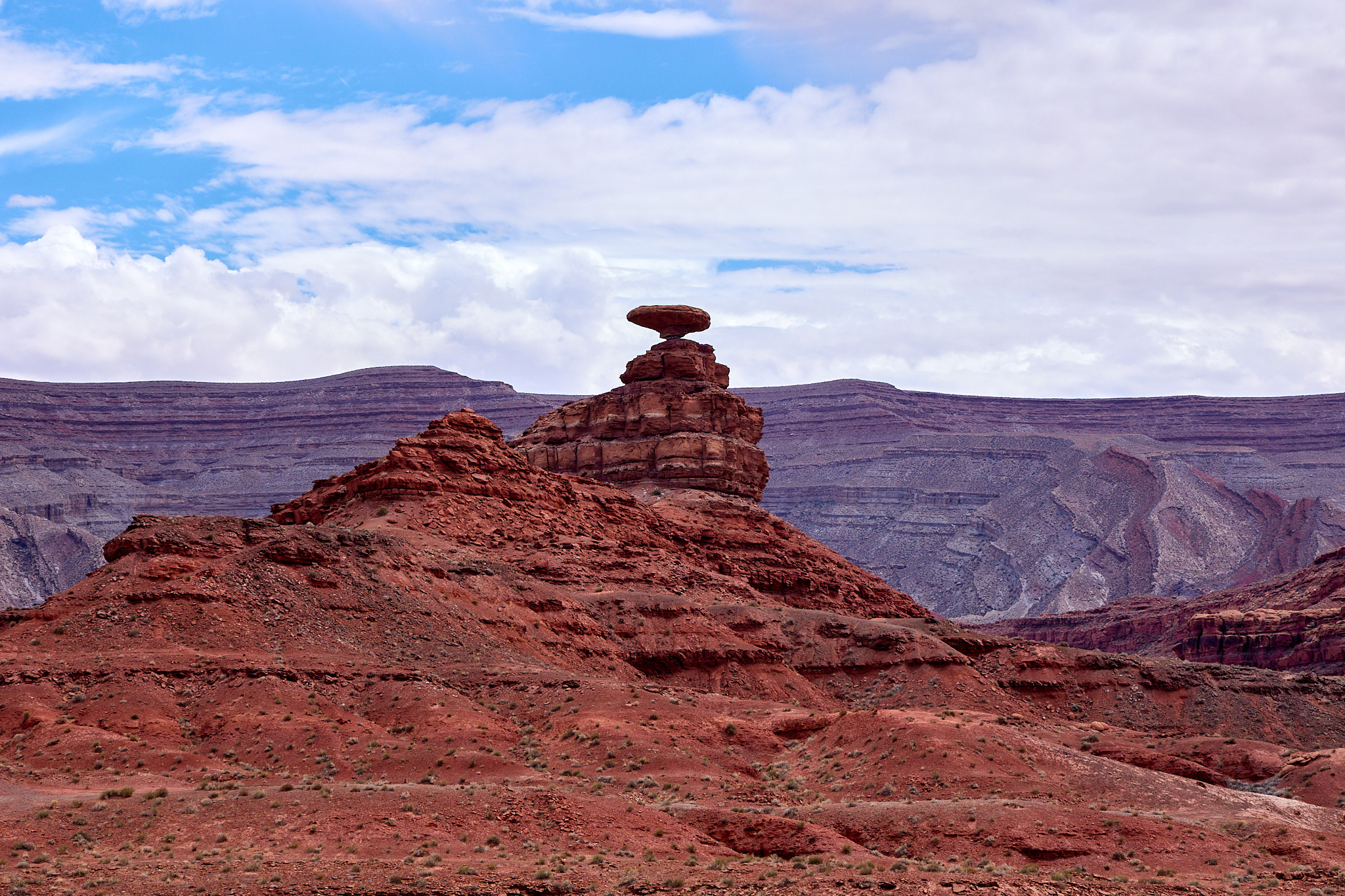
There was an unscheduled stop at the formation that gave the town of Mexican Hat its name. It's a road trip and I can do these things.
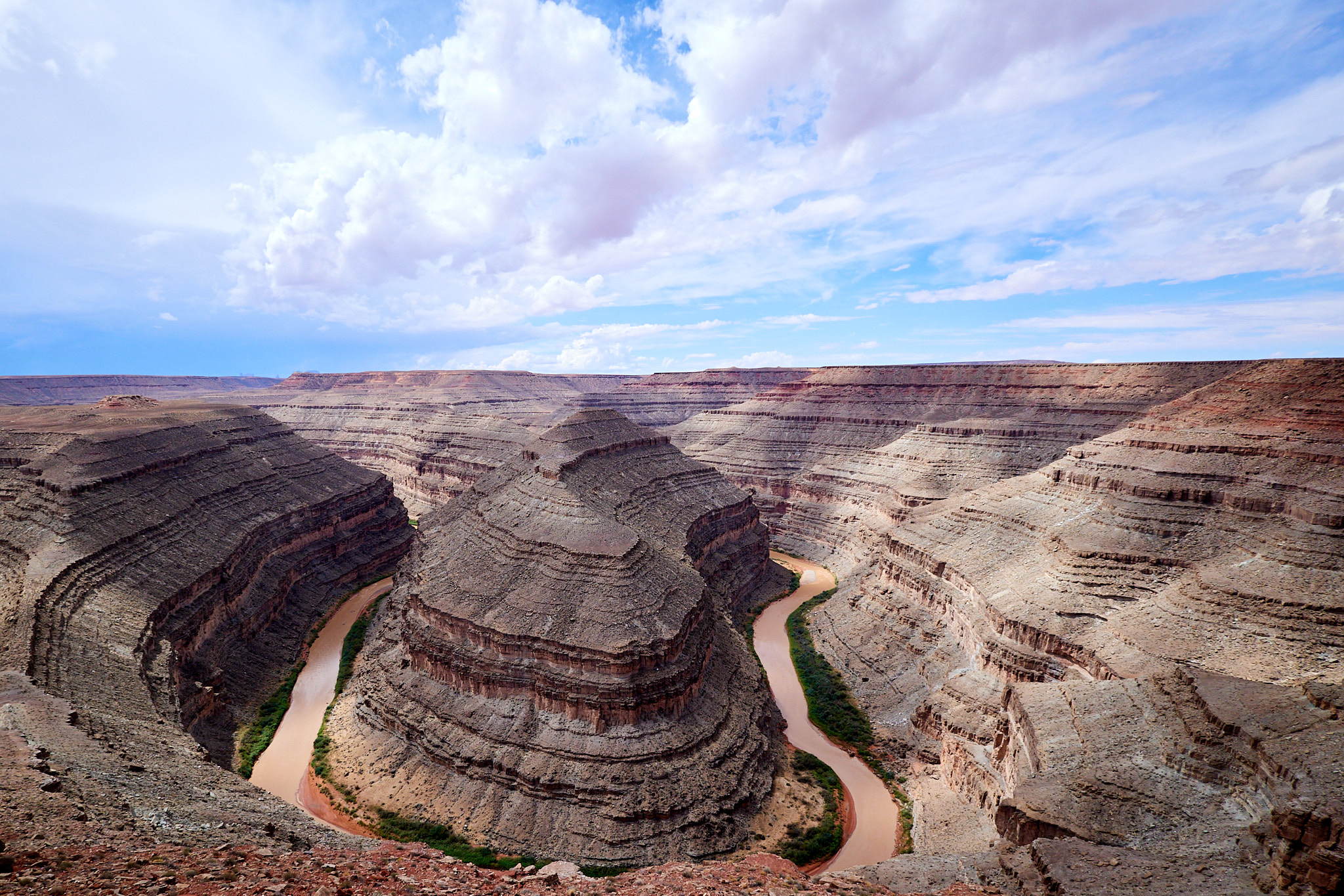
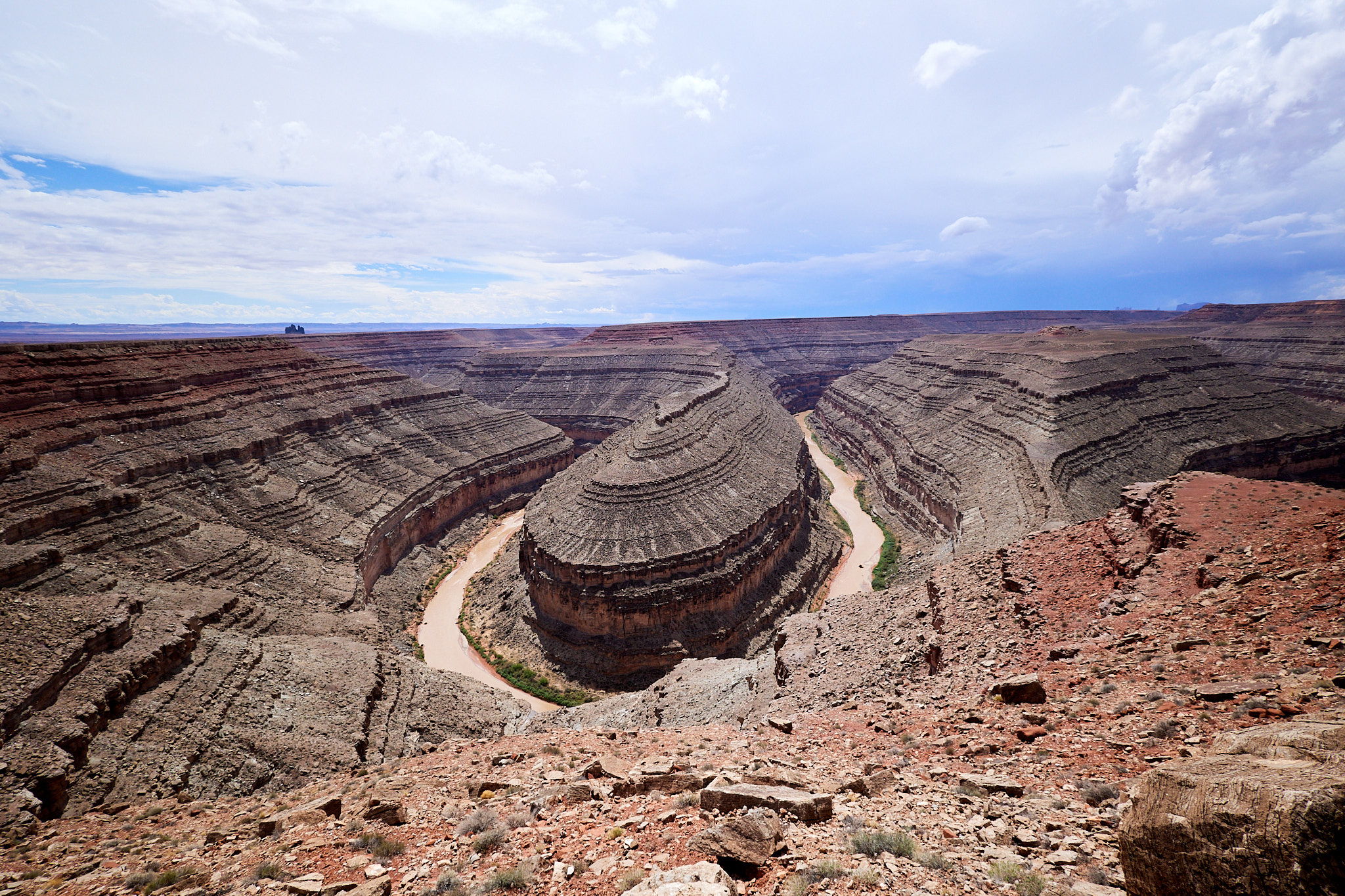
Gooseneck State Park was along the route, and it has pretty scenery. If you're wondering what a Gooseneck is in this case, it's a river feature. Think oxbow with a good belt. Or just look at the pictures. There are actually two goosenecks right next to each other to double your pleasure!
I continued on to Valley of the Gods. As it turns out, this is not dissimilar to Monument Valley. Coincidentally (or maybe a competition?) it's also a 17 mile road (also 60-90 minutes) that you take from end to end, and it goes through a different collection of buttes and mesas. I can't really say which is prettier as they both are beautiful rugged scenery. I also can't say which road was worse; both have their ups and downs...
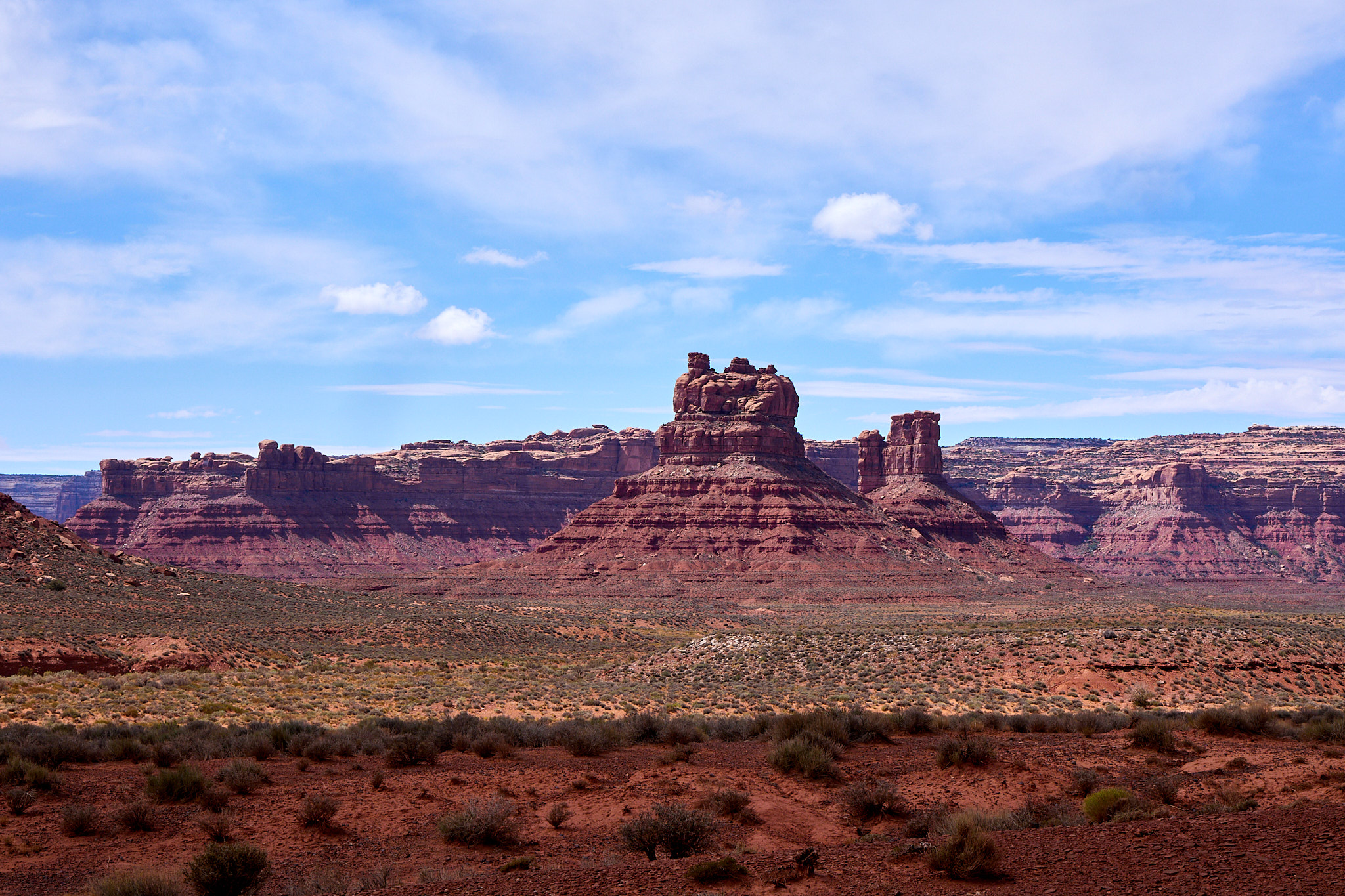
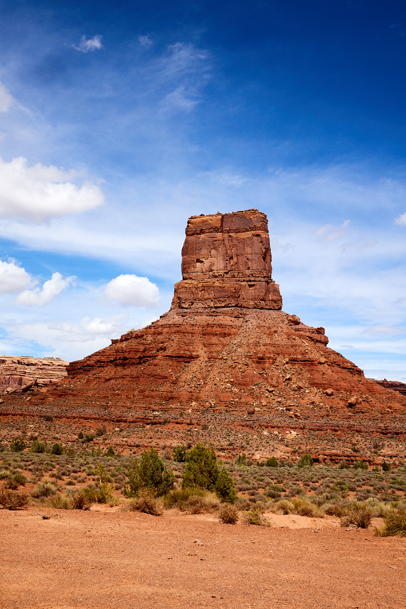
I would not recommend doing both in the same day. They are only 30 minutes apart which drew me in, but the effort for each one is high and they are similar enough that I think I got a little numbed by the first one that I didn't spend enough time appreciating the second. Take a night in Mexican Hat or somewhere to rest up in between.
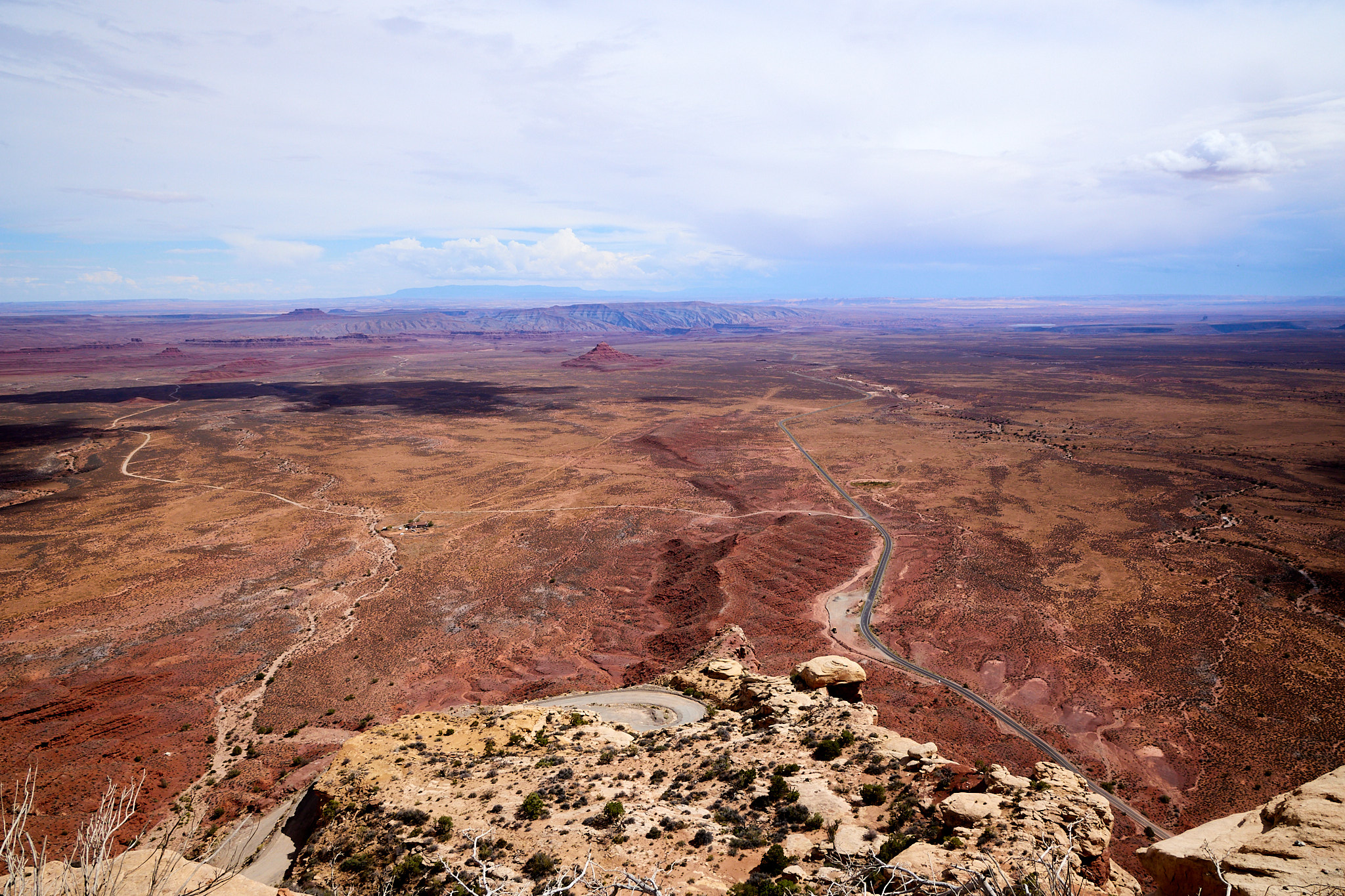
I was originally planning on dispersed camping in Valley of the Gods, but it was 1:00 PM and over 80 and getting hotter. I decided to continue on to my next destination and spend the night at Natural Bridges National Monument. It was only 30 miles up the road, but it seemed to take a long time on the GPS. I soon found out why. I've never seen anything like the Moki Dugway. They hung a gravel road (gravel to slow you down I'd guess since there are no guardrails) on the side of a mesa over 1000 feet high. It was like a road winding up around a couple points of something I'd expect to see Wile E Coyote plummeting from. I wish I would have taken a picture before starting up, but the best I have is a picture from near the top.
After a 30 mile detour for gas, I ended up in the campground for the night. It's pretty minimalist but I'm just happy to be off the road.
Hiking distance: It was an arm day