Natural Bridges
2025-09-07
Natural Bridges National Monument and Goblin Valley, UT
Yesterday afternoon I decided to press on to Natural Bridges National Monument to spend the night, and that paid off today. I was able to pack up and get on the trail by 8:00 AM, albeit still later than I'd hoped. A little bit too much time packing.
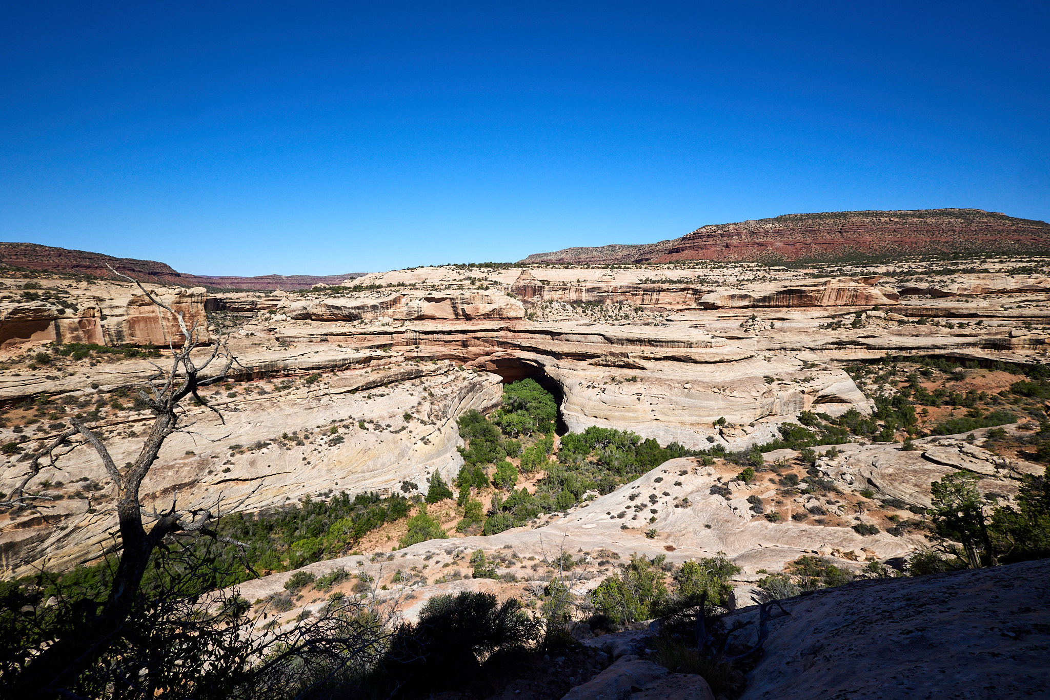
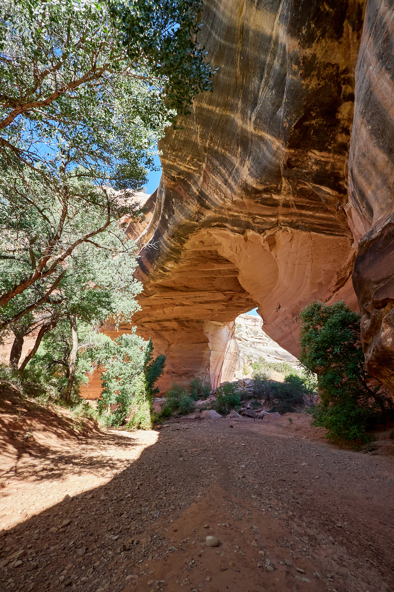
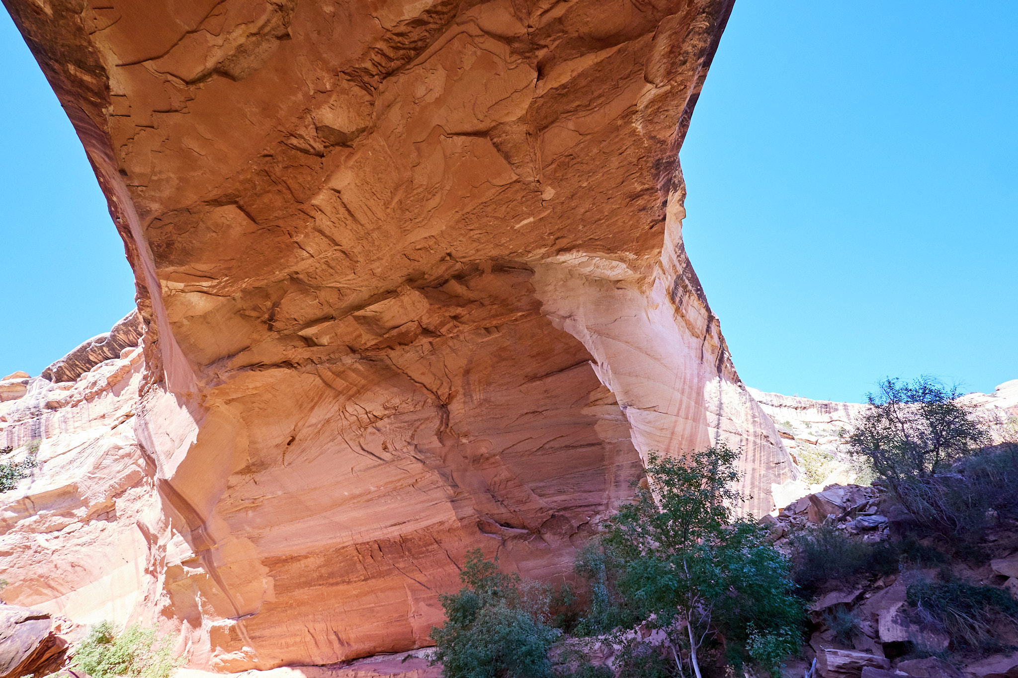
There are three bridges at Natural Bridges: Sipapu, Kachina, and Owachomo. You can view them from the top, or you can go down to the valley floor and look up at them. Each of the bridges is 500 or so feet down, so to visit them it's a lot of up and down in a short span. Think stairs, ladders, chutes, partial railings on smooth rock, and walking close to the edge.
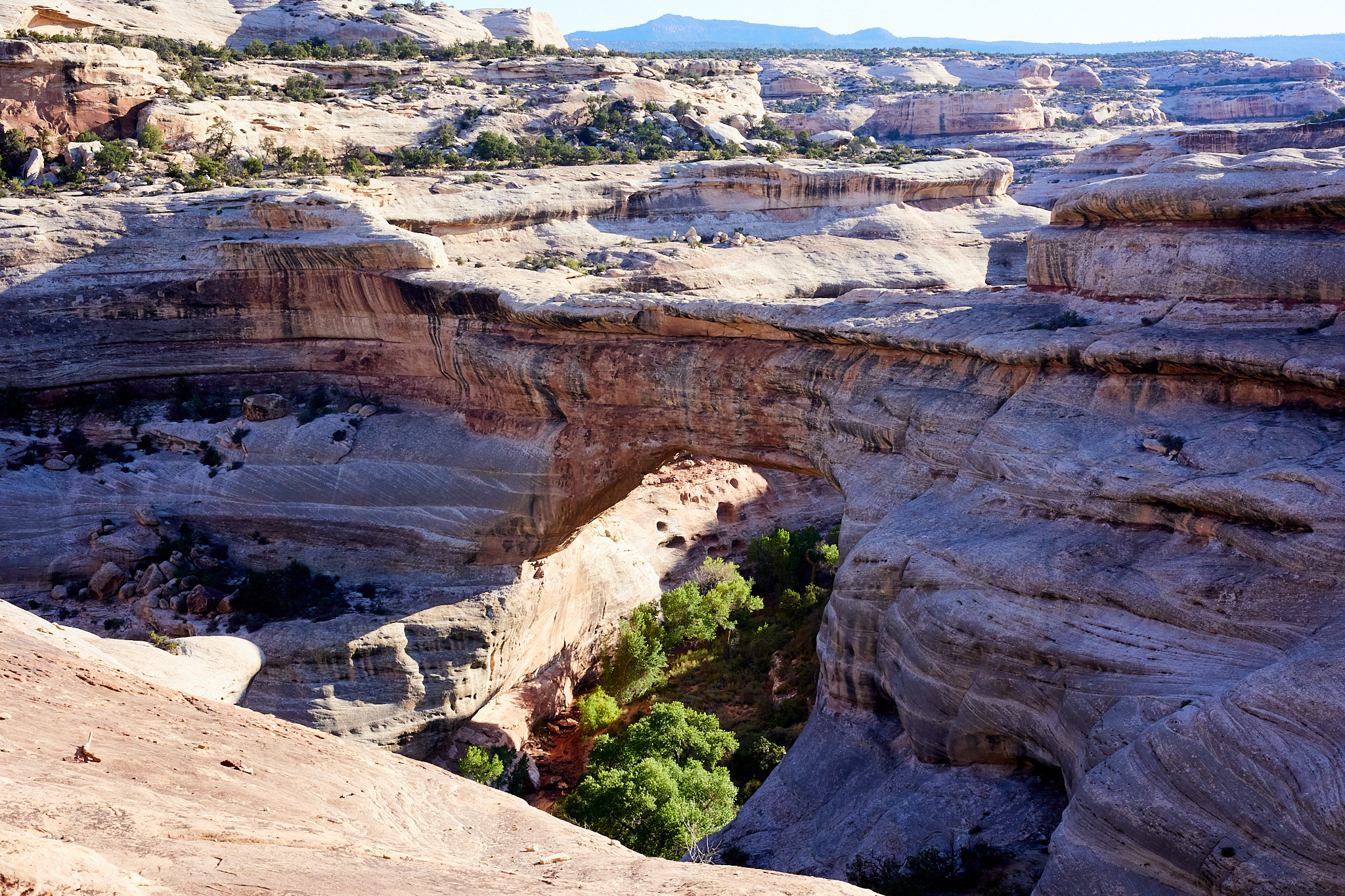
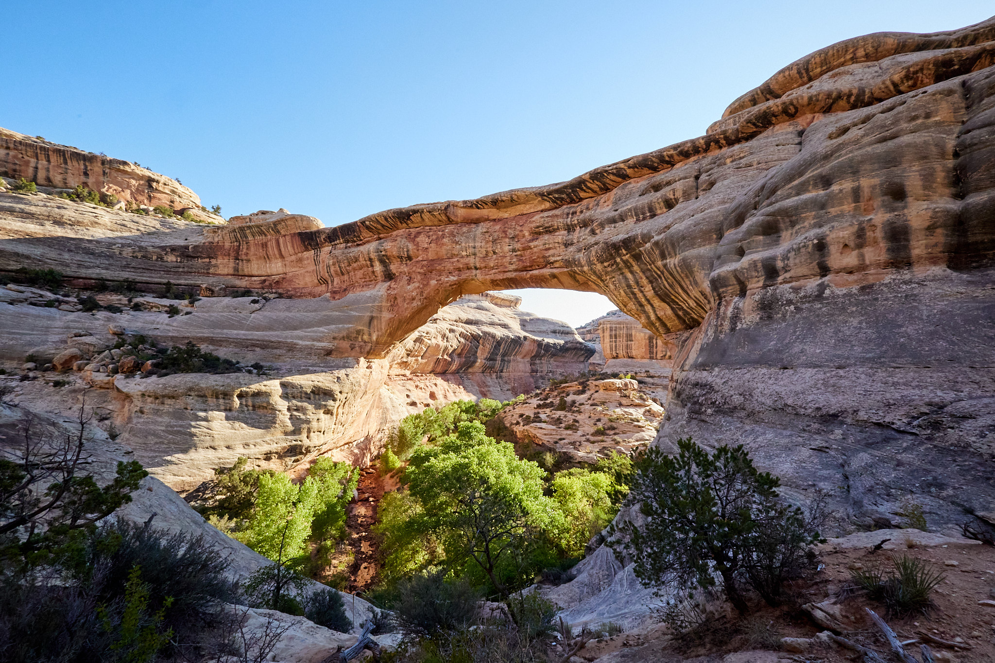
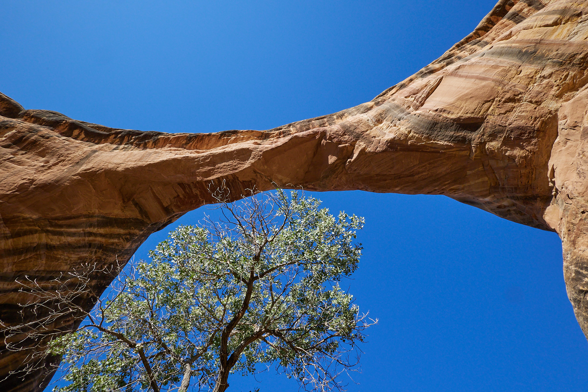
I decided to get up close with two of the bridges by going down at Sipapu, cutting through the canyon, and then climbing the stairs on Kachina. I do love a good canyon hike. It's mostly shady, and the walls are often magnificent as they've been carved for so many years. It reminded me of The Narrows at Zion National Park, although there the river is running whereas the White Canyon at the bridges is no longer a river but more a seasonal creek; currently a collection large puddles, rocky sections, and incredibly sticky mud. Also, there are way, way fewer people at the bridges. Probably fewer in a year than Zion gets in a day.
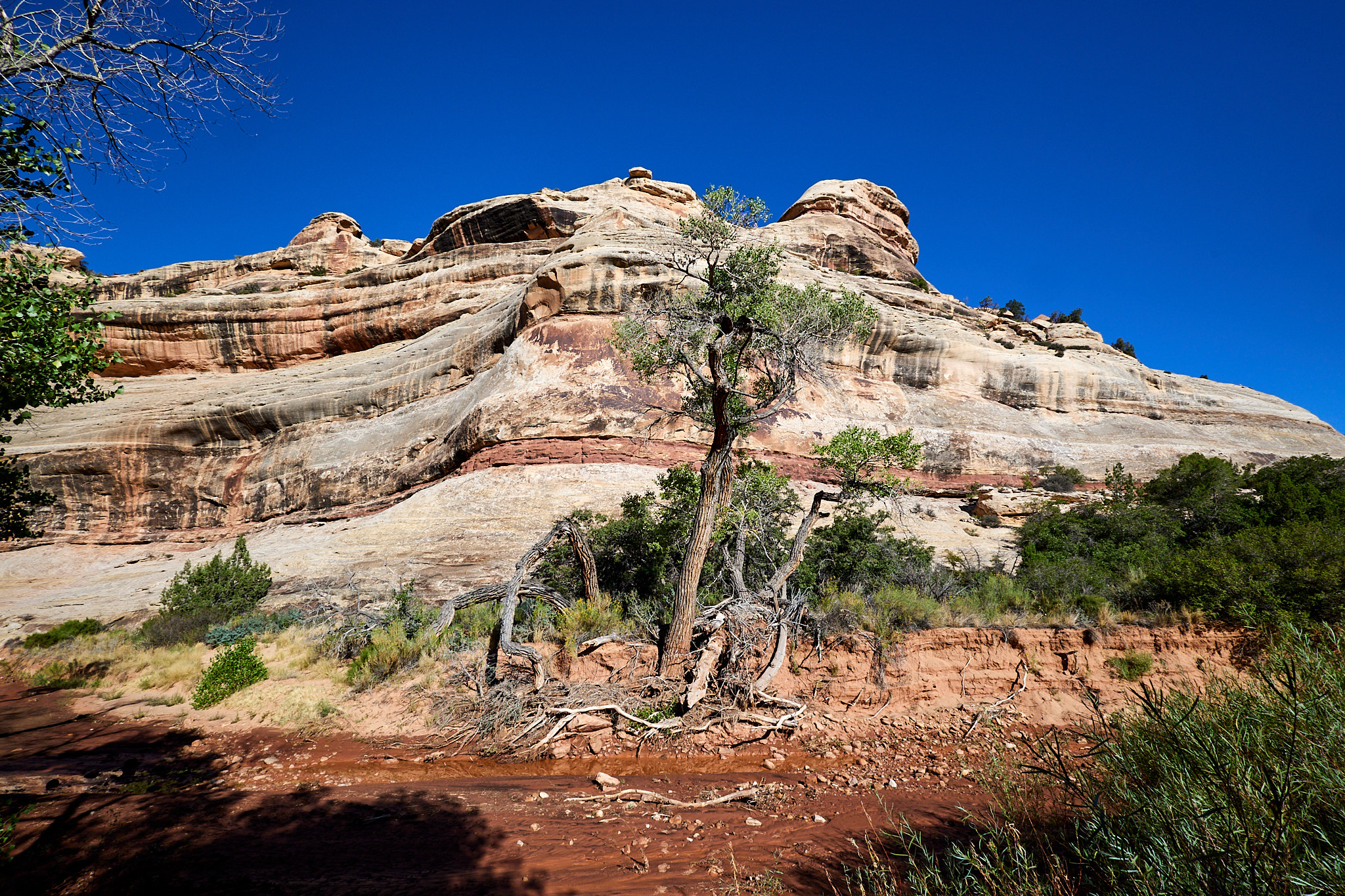
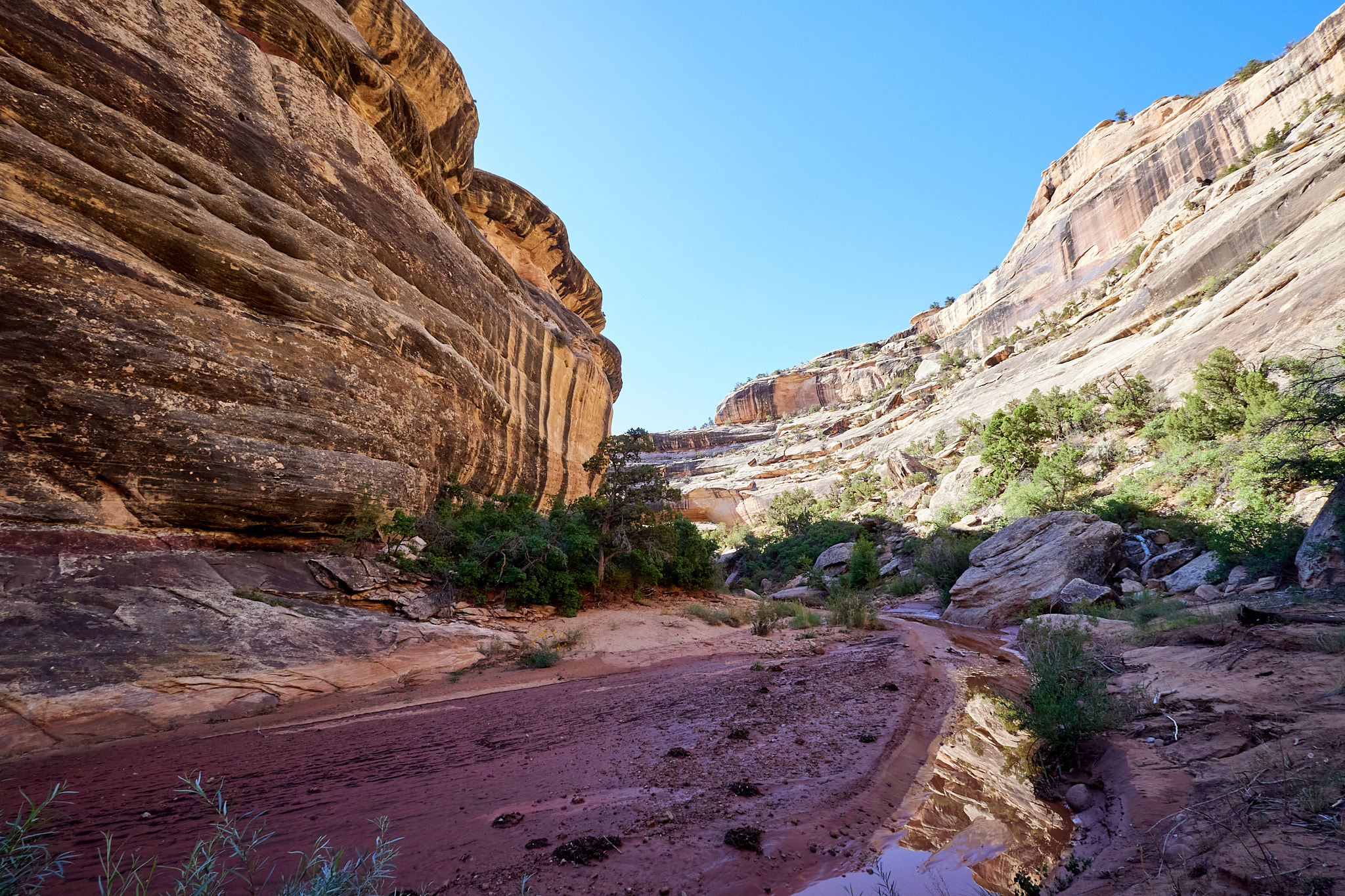
The path through the canyon is described as "unmaintained," but that doesn't tell the real story of the trail. There are sections through wider areas in the canyon which are paths where the brush doesn't grow (trampled) but reaches in from the side; when you're on one of those it's straightforward. However, the "trail" keeps switching back and forth as to which side of the muddy puddles it is on. That makes sense, because there is often no land on the outside bend of a river so the trail needs to follow the inside where there is usually some land. The challenge became figuring out when to cross in order to pick up the trail, and to avoid walking in the sticky mud which made your shoes pounds heavier until it dried and powdered off. It took me a while to figure out what the hike was doing, and that many pieces of the trail simply washed away each time it rained so I was on my own. It was a very technical hike which meant I didn't spend as much time enjoying the canyon as I would have liked, but it was a lot of fun. If the river was a bit drier, I think it would have been pretty easy to just walk up the middle.
After cresting Kachina (still not fully acclimated to 6200 feet so the climb took a while), I was about four miles in but I still had to cross the mesa for two miles back to my car. The good news is that the trail over the top is mostly bare rock and is not overgrown. Unfortunately it was now about 11:00 and hot. I had enough water, but the smart people found a way to skip this part with two cars or whatever. It had some more steep climbs that I didn't feel I needed.
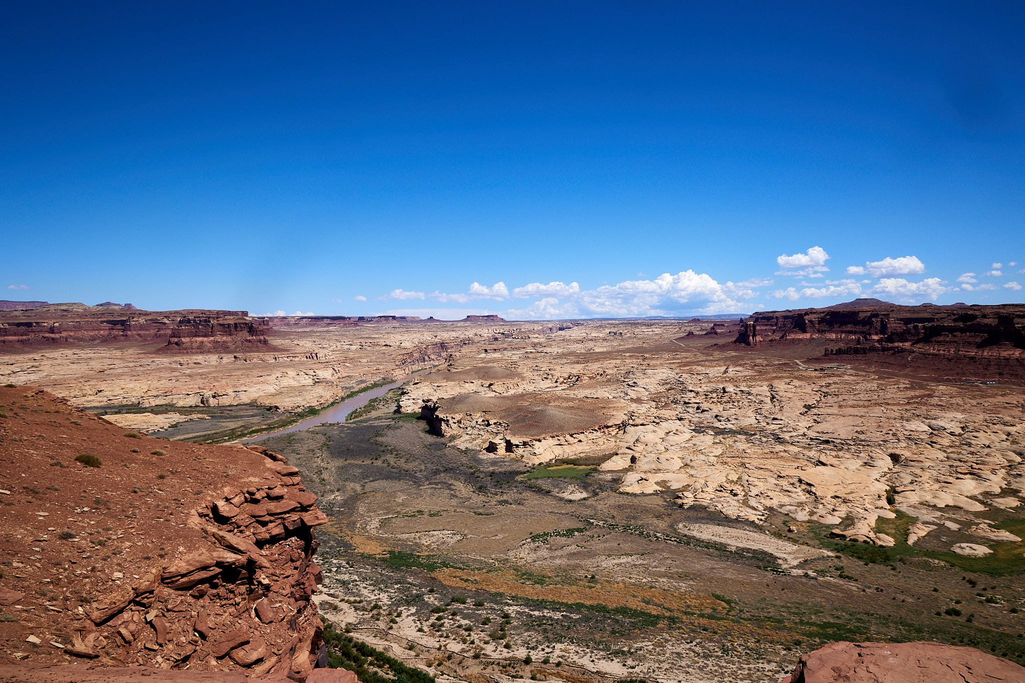
The road I took leaving the park wound through Glen Canyon Recreational Area. The scenery was absolutely amazing. Multicolored mesas or hoodoos with sculptured tops littered the landscape. It is just amazing, but I'm probably not the guy to describe it in detail.
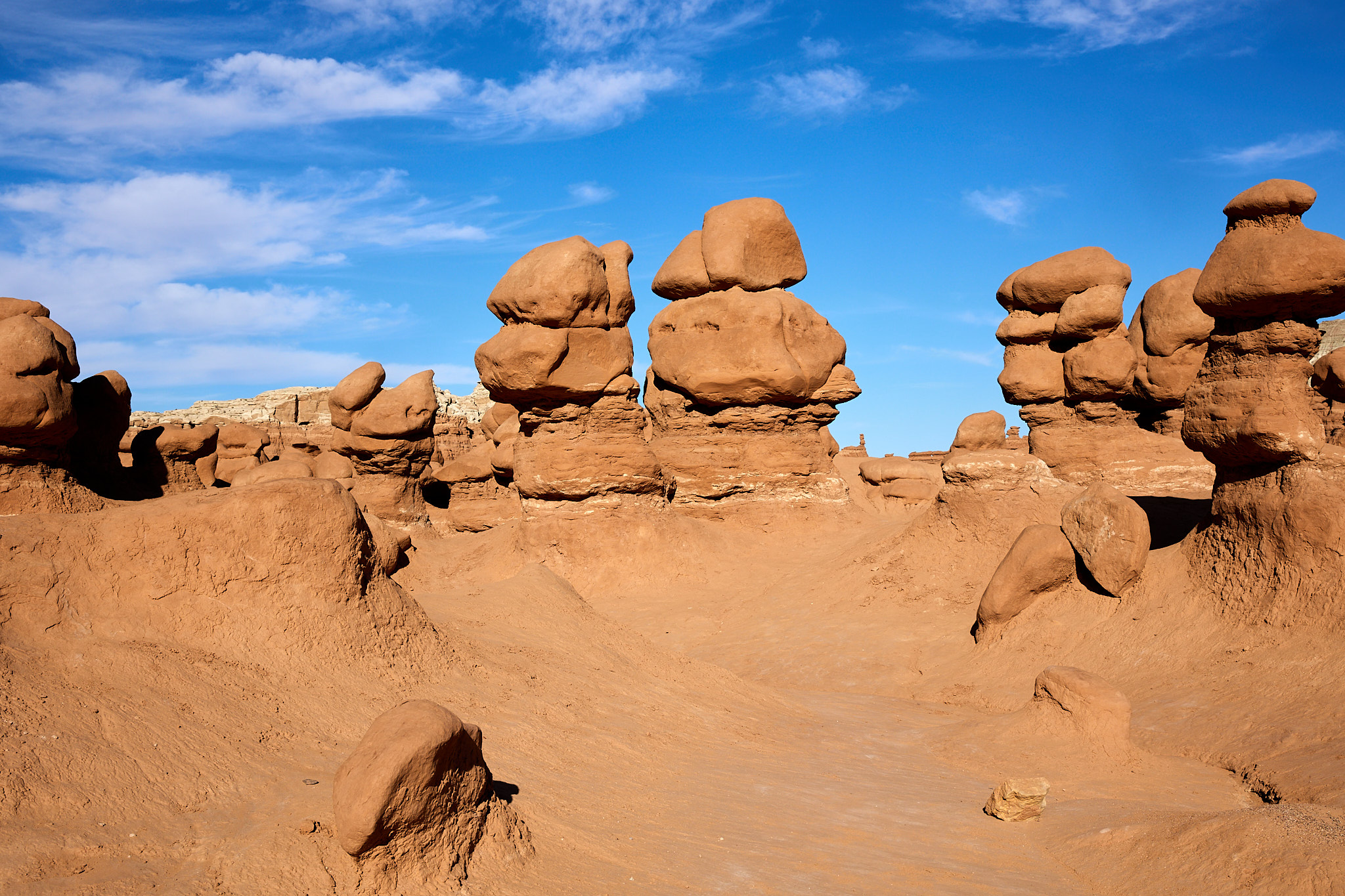
The next destination is Goblin Valley, Utah. This is a valley full of hoodoos that are relatively short, less than 20 feet. There are three valleys but I only explored a bit of the first one because I was still spent from the morning hike and frankly it was hot. I'm not sure how the others differ other than distance from the parking lot.
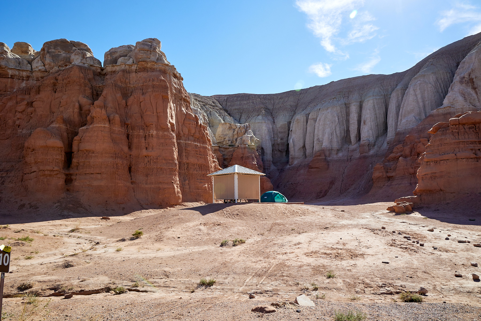
My campsite is a walk-in, set back from the road a little bit. The number of trips made for a forgotten item always seems to be proportional to the distance to the car. But it is lovely and I'm here for two nights at least so it's less hassle that it could be. It's also 200 yards to the bathhouse which would be more of a bummer at night if the full moon wasn't making it near day.
Hiking Distance: 6.8 miles